

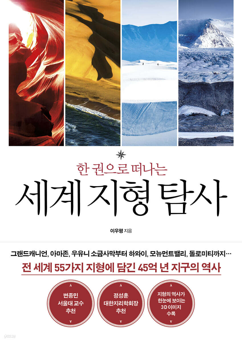
Exploring the World's Geography in One Volume
 |
Description
Book Introduction
This book, which contains diverse terrains from around the world, will open a new chapter in nature learning for all of us.
Leads.
-Jeong Seong-hun, President of the Korean Geographical Society
From the Grand Canyon, the Amazon, and the Uyuni Salt Flats to Hawaii, Monument Valley, and the Dolomites.
A geography teacher with 30 years of experience shares stories of beautiful and mysterious landforms from around the world.
Geography teacher Lee Woo-pyeong, who introduced countless readers to the beautiful nature and unique landforms of our land through "Korean Geography Walk," has now returned with "World Geography Exploration in One Volume," a book containing 56 representative landforms from around the world.
This book selects beautiful and mysterious landforms from six continents, including the Grand Canyon, Yellowstone National Park, the Amazon, the Uyuni Salt Flats, the Seven Sisters, the Dolomites, Tsichai Dansha, Pamukkale, Lake Natron, and Uluru. It introduces the current appearance, formation process, ecosystem changes, and natural historical value of each landform in an easy-to-understand manner based on the latest research and abundant image data.
This comprehensive guide to the diverse geographic features of Earth's 4.5 billion-year history will be useful not only to readers interested in geography and natural history, but also to anyone wishing to embark on a journey into the vast and beautiful outdoors.
- You can preview some of the book's contents.
Preview
index
Opening remarks
Part 1 North America
Yellowstone National Park, a collection of geysers and hot springs created by water and heat│Arches National Park, a park of natural arch-shaped rock sculptures│Monument Valley, a feast of rock pillars and rocky hills in the desert plains│Antelope Canyon, a feast of light in a canyon hidden by Page│Grand Canyon, a grand canyon where you can catch a glimpse of the Earth's annual rings│The Wave, a masterpiece of natural art created by undulating cross-bedding│Bryce Canyon, a feast of spire-shaped hoodoos│Death Valley, a valley too harsh for living things│Yosemite National Park, a spectacular sight of granite canyons carved by glaciers│White Sands National Park, a silvery new world created by white gypsum sand│Spotted Lake, the world's only speckled lake│Tuktoyaktuk, a typical example of periglacial landform in the tundra permafrost zone
Part 2 South America
Naica Cave, the world's largest crystal treasure trove│The Great Blue Hole, the prototype of the underwater sinkhole atoll│Canaima National Park, a tepuy paradise preserving the beauty of the primitive world│Caño Cristales, the world's most beautiful rainbow-colored river│Lensóis Sand Dunes, beautiful sand dunes straddling the desert and the lake│The Amazon River, South America's gentle giant that nurtured the rainforest│Uyuni Salt Flats, the two faces of the desert and the lake
Part 3 Europe
Seven Sisters, a panorama of chalk sea cliffs│Giant's Causeway, a feast of polygonal columnar joints│Dolomites, the epitome of Alpine dolomite mountain scenery│Mount Etna, a symbol of active volcanoes that demonstrate the vitality of the Earth│Fjords, a Nordic wonder created by glaciers│Iceland, where fire and ice coexist│Greenland, from a pure white ice world to a green land│Montserrat, a scenic spot with jagged conglomerate peaks
Part 4 Asia
Siberia, a frigid land called the 'sleeping land' │ Qichai Danxia, folds blooming with a seven-colored rainbow │ Yellow River, the cradle of Chinese civilization │ Huanglonggou and Jiuzhaigou, a feast of water in Sichuan │ Yangtze River, the history of the great river that created Chinese civilization │ Huangshan, a world-famous mountain carved from granite │ Wulingyuan, a natural labyrinth filled with gigantic rock pillars │ Halong Bay, a paradise of turquoise sea tower karst │ The Himalayas, the roof of the world │ Bohol Island's karst, a feast of chocolate hills gathered in one place │ Klimutu Lake, a pigment pot perched on a mountaintop │ Goreme Valley, a 'fairy chimney' filled with mushroom rocks │ Pamukkale, the prototype of pure white travertine terraces
Part 5 Africa
Nile River, the cradle of Egyptian civilization 466│Sahara Desert, the largest golden sand empire on Earth│Richard Structure, the 'Eye of the Earth' that can only be properly seen from an altitude of 10km or higher│Lake Retba, synonymous with pink lakes│East African Rift Valley, the cradle of human birth and a paradise for wildlife│Lake Natron, the cursed lake of death│Mosi-oa-Tunya Falls, the largest water curtain on Earth│Namib Desert, a sandy sea where the desert and the coast meet│Bemaraha Tsinggi Lands, the epitome of limestone pinnacle panorama│Cape Mohnne Underwater Falls, a waterfall created by optical illusion
Part 6 Oceania - Oceans
Bungle Bungle Mountains, sedimentary rock formations where the first life on Earth was formed│Great Barrier Reef, the world's largest coral reef community│Uluru-Kata Tjuta National Park, the world's largest example of Inselberg│Waitomo Caves, the Milky Way unfolding in the underground world│Hawaii Islands, the example of submarine volcanoes formed by hotspot chains│Galapagos Islands, the birthplace of Darwin's theory of evolution
References
Image source
Search
Detailed image
Into the book
In Yellowstone, the massive underground heat energy is released to the surface in various forms, allowing you to experience a truly 'living, vibrant Earth'.
And not only is the scenery beautiful with the V-shaped canyons, waterfalls, rock formations, lakes, and forests created by the Yellowstone River, but it is also a paradise for wild animals such as deer, buffalo (called bison or buffalo), bears, and wolves, so it has high natural historical value.
In 1872, President Grant designated Yellowstone as the first national park in the United States, making it the world's first national park.
--- pp.16~17
Yellowstone's greatest geological feature is its geysers, which erupt periodically from underground hot water to the surface.
The most famous geyser, Old Faithful, spews water and steam up to 60 meters high every 90 minutes, creating a terrifying sight.
Geysers can also be found in volcanic areas like Japan, New Zealand, and Iceland, but Yellowstone has about 300 geysers, which is two-thirds of the total on Earth.
--- p.21
Death Valley's climate is the hottest and driest in North America because water vapor from the Pacific Ocean is blocked by the Sierra Nevada Mountains and then again by the Amargosa and Panamint Mountains, preventing it from reaching the Death Valley region, which is located deep inland.
The Foehn phenomenon, in which air laden with water vapor that flows inland loses moisture as it rises over the mountain range and its temperature rises as it descends (this is the case with the high winds that occur when the northeast wind blowing from the Sea of Okhotsk crosses the Taebaek Mountains in early summer in Korea), also contributes to the dry climate of Death Valley.
--- pp.96~97
Approximately 11,000 pingos, measuring approximately 3 to 7 meters in height and 30 to 100 meters in diameter, have developed along the entire Arctic coast, with approximately 1,350 concentrated on the Tuktoyaktuk Peninsula.
Pingo's ice typically grows only a few centimeters per year, forming as ice beneath the sediments on the lakebed in winter gradually increases in volume and lifts the ice off the surface.
On the other hand, when the top sedimentary layer of the pingo is eroded and dissolved in the summer, the ice is exposed and melts, creating a lagoon, where the meltwater accumulates and forms a small lake.
Through this process, Pingo repeats growth and disintegration.
Due to global warming, the ice core at the summit is rapidly melting, exposing it, so it seems unlikely that Pingo will be seen again in the near future.
--- p.140
Coral reefs are reefs formed by the accumulation of calcareous skeletons and secretions of calcium carbonate after the death of coral. Depending on the location of the island and coral, they are classified as fringing reefs (coral reefs that develop around islands or land), barrier reefs, and atolls.
Atolls, which are arranged in a ring-shaped band above the sea, are thought to be formed by the growth of coral reefs that have formed on the edges of round craters below sea level.
However, British biologist Charles Darwin discovered that atolls, on the contrary, are formed when coral reefs that grow around volcanic islands sink and remain in a ring shape.
--- p.159
The rise and fall of sea levels are influenced by the development and decline of glaciers.
As the Earth's temperature drops, glaciers in polar and mountainous regions expand, causing sea levels to fall.
On the other hand, as the Earth's temperature rises, glaciers melt and sea levels rise.
From about 2 million years ago to the present, there have been five major ice ages and four interglacials (warmer periods between glacial periods when temperatures were relatively high compared to the glacial periods) in between.
As a result, the Great Blue Hole has repeatedly been submerged by the sea as sea levels rise and fall and become land as glaciers rise and fall.
--- p.162
A unique phenomenon can be observed at the mouth of the Amazon River where it meets the sea.
The Amazon River estuary region has a large tidal range, so the sea level rises above the river level during high tide.
At this time, the river water cannot flow into the sea and flows back upstream at a rapid speed of about 70 km/h, creating huge waves of about 5 m high.
It looks like a tsunami is coming, and this is called a 'resolution phenomenon'.
--- p.201
Before the Andes formed, a group of dolphins that used to travel between the Amazon River and the Pacific Ocean were trapped in the rivers when the Andes formed, and they evolved independently, adapting to freshwater systems.
The largest of the river dolphins is the Amazon river dolphin, also known as the 'boto'.
--- pp.204~205
The Uyuni Salt Flats are constantly changing throughout the year.
During the dry season from April to November, it is a desert of salt, but during the rainy season from December to March, it is a lake that is submerged in water to a depth of about 20 to 30 cm, so it is also called a salt lake.
It is known as a desert in Korea because the dry season lasts longer than the rainy season when it is submerged in water.
However, in English-speaking countries, it is also called the 'Salt Plains' due to its geographical feature of being a wide plain.
--- p.212
Iceland's land area is expanding slightly each year due to ongoing volcanic activity and magma eruptions.
According to measurements taken by the Icelandic National Survey in 2017, the country is expanding eastward in the east and westward in the west by about 2 cm per year.
Over the past 9,000 years, Iceland has expanded by about 70 meters from east to west, mainly because it is a volcanic island straddling the Mid-Atlantic Ridge.
--- pp.283~284
Another feature of Montserrat is its unusual and diverse rock formations, which come in shapes such as cones, carrots, or bananas.
The conglomerate layer of Montserrat is a horizontal layer with almost no folded structure caused by tectonic movements.
This is because the Montserrat area was hardly affected by folding during the process of the Alpine Orogenic Belt being formed by the collision of the African Plate and the Eurasian Plate.
Instead, numerous fault lines running in a northwest-southeast direction have developed due to the severe faulting, such as cracking, sinking, and rising of the crust.
--- p.312
The multi-colored bands of Chichaidansha are layers of sedimentary rock that were laid down sequentially at different times.
The stratum is inclined at an angle, indicating that it has undergone tectonic movements such as folding.
Chichaidansha began to form about 500 million years ago in the Paleozoic era.
The white layer right next to the red layer of Chichaidansha is made of limestone, which was formed when coral and seashells were deposited here about 500 million years ago when this area was a sea.
--- p.337
The current Yangtze River originates from the Tibetan Plateau, flows eastward across central China, and then flows into the East China Sea.
In the past, a single stream was divided into two rivers by the Wushan Mountains in Hubei Province, flowing in opposite directions.
Afterwards, these rivers were connected to form the present-day Changjiang River.
The course of the Changjiang River can be seen as a complex result of processes such as headwater erosion, river contention, and course change, similar to the Colorado River that flows through the Grand Canyon in the western United States.
--- p.373
The scientific name for the Chocolate Hills is Conkarst.
It was formed by the dissolution of limestone, the rock that makes up the Chocolate Hills, and its name comes from its shape resembling a cone or cone.
Conkarst belongs to the remnant landforms formed by differential erosion of limestone areas.
The river flowing along the joints of the earth's surface eroded the surrounding limestone, and the remaining hills are the present-day Chocolate Hills.
When the erosion progresses further than a cone and becomes closer to a tower shape, it is called a tower karst. Guilin, China and Halong Bay, Vietnam, seen above are examples of this.
--- p.426
The rock pillars of the Goreme Valley are punctured with countless honeycomb-shaped holes.
These holes are cave dwellings dug into the rock face to allow people to live inside, and it is estimated that people began living here around 4,000 years ago when the Hittites ruled.
The reason for creating cave dwellings was that the inland grasslands and semi-arid regions had unfavorable vegetation conditions and wood was scarce, while the tuff formed by hardening volcanic ash was soft and weak, making it easy to dig caves using sharp trees and stones.
--- p.449
Pamukkale was formed when hot spring water of about 35-50℃ rose from a fissure in the earth's crust underground in the limestone layer formed at the top of a hill during the Paleozoic and Mesozoic eras, flowed down the mountainside, and the calcium carbonate dissolved in the hot spring water precipitated and solidified in steps.
Therefore, the identity of the white powder is all lumps of calcium carbonate contained in limestone.
If you dip your hands into the hot spring water in the pool, you will collect the precipitated calcium carbonate powder.
As this slowly flows, it accumulates and hardens, creating a calcified terrace.
--- p.457
Every year, over 180 million tons of sand are released into the air from the Sahara Desert, and it is known that about 27.7 million tons of this sand dust is carried by the wind across the Atlantic Ocean in a single day and falls in the Amazon River basin in South America.
The United States Geological Survey took note of this and calculated the age of sand dust deposited in the Canary Islands off the coast of Morocco, west of the African continent.
--- p.481
The Richat Structure, located in western Mauritania in the Sahara Desert of North Africa, is a massive, circular vortex-shaped structure with a diameter of up to 50 kilometers in a vast desert area.
Its size and scale are so vast that to see its full form, you must climb to an altitude of at least 10 km.
--- p.492
The African and Arabian plates, which were initially connected to each other, began to split into three plates about 100 million years ago. Currently, the Arabian plate, the Afro-Somali plate, and the Afro-Nubian plate are splitting apart in a Y-shaped triple rift, moving away from each other across a fault zone.
The faulting and subduction that began about 20 million years ago continues unabated, and it is said that in 10 million years, the African continent will split in two.
--- p.512
Among birds, only the lesser flamingo (also called the lesser flamingo, a species found in the East African Rift Valley) uses this area as its breeding ground.
During the dry season, when the salinity of the lake increases, salt-loving blue-green algae flourish, and the number of crustaceans and ring-shaped or flat-shaped invertebrates that feed on them increases, creating conditions that are favorable for feeding and easy for raising young.
During the dry season, you can see a spectacular sight of the lake turning pink as about 2.5 million little flamingos flock to the lake.
This is also the reason why Lake Natron became an internationally protected wetland under the Ramsar Convention in 2001.
--- p.528
During the rainy season, a huge amount of water, approximately 300,000 cubic meters per minute, pours down.
The indigenous Kololo people called it "Mosi-oa-Tunya," meaning "the smoke that roars like thunder," because of the cloudy mist and thunderous roar that can be heard around the falls.
British explorer David Livingstone, who first discovered the falls in 1855, named them Victoria Falls after Queen Victoria.
--- p.535
Why did prosimians, once thought extinct, survive only on Madagascar? Madagascar split from the African continent approximately 150 million years ago.
This is because they evolved independently in an isolated island environment, without ancestors of large predators such as lions and leopards, and without competing hominids.
--- p.564
In 2017, the discovery of zircon grains estimated to be about 3 billion years old in Mauritius attracted extraordinary attention from the scientific community.
Zircon is a silicate mineral found within granite that is resistant to weathering and hard enough not to melt in magma. It is also a mineral that represents the geological record well, so its discovery is very significant.
Zircons are generally found in rocks of older continental crust rather than younger oceanic crust, but Mauritius belongs to the younger oceanic crust, having been formed only about 10 million years ago.
--- p.570
The reason Waitomo Caves are world famous is because of the blue-green luminescence inside the cave.
Glowworms, a type of firefly or dung beetle that lives inside caves, are known to emit light.
However, this creature is actually the larva of a fungus fly insect called Arachnocampa luminosa.
It is simply called a glowworm because it has the property of emitting light.
Arachnocampa luminosa is 5mm to 3cm in size, and spends 6 to 9 months in the larval stage. It has luminescent cells in the excretory organ at the end of its body that emit light.
It is an endemic species that only lives in New Zealand and Australia and has very high ecological value.
--- p.616
Most volcanoes occur at the boundaries of the Earth's tectonic plates, where they collide, separate, or slide past each other.
However, the Hawaiian Islands, located in the middle of the Pacific Ocean, are the most volcanically active in the world, even though they are not on a plate boundary.
This is because the Hawaiian Islands have volcanic activity through hot spot eruptions, in which magma from the mantle deep in the oceanic crust erupts through the crust, regardless of plate movement.
--- p.626
When people think of 'volcanic activity', they usually think of explosive and destructive volcanic eruptions.
However, Mount Kilauea on the island of Hawaii, the most active volcano in the Hawaiian Islands, is unique in that it erupts quietly and gently, and you can see the red-hot lava masses up close.
--- p.629
Publisher's Review
A vivid natural history journey that goes beyond the Korean Peninsula and into the world.
4.5 billion years of Earth's history captured in 56 geographic locations around the world.
Named for its undulating patterns that resemble waves across the rocky valley, 'The Wave' is one of the most remarkable landforms that has captivated the world.
How are ripples carved into hard rock? The answer is water and wind.
The sandstone layer that was formed 190 million years ago was eroded by rainwater over thousands of years, and sand blown by the wind moved along the ditch, gradually eroding the surface, creating ripple patterns (pp. 78-79).
In this way, the terrain is a masterpiece created by Mother Nature over billions of years, recording the history of the Earth.
The 'World' version of 'Korean Topography Walk', which has been praised by numerous humanities readers, teachers, and students as a 'second major book', 'a substantial and faithful special lecture on the natural history of the Korean Peninsula', and 'a vivid field trip report', has been published, 'A World Topography Exploration in One Volume'.
The author, who has studied and taught geography throughout his life, has selected 56 of the most famous and historically valuable geographic sites not only on the Korean Peninsula but also around the world, and compiled them into one volume.
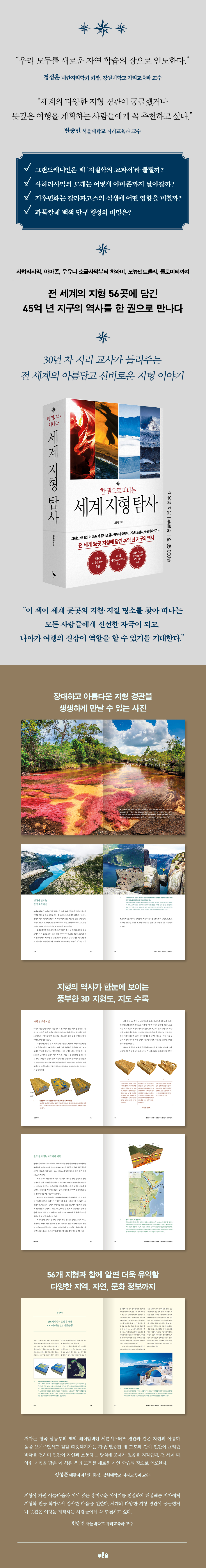
Comprehensive with the latest research in geology, geomorphology, ecology, and biology, this book offers a wealth of fascinating information, including beautiful panoramic photographs, 3D topographic maps that illustrate the formation and evolution of landforms, stratigraphic cross-sections, and maps.
Additionally, along with the 56 geographical features, it includes short articles titled “Should I go here too?” and “Reading Materials” that provide even more useful information about the region, society, culture, history, and ecology, adding to the enjoyment of reading.
While there have been books covering the topography and geology of certain regions, such as the western United States, China, and Australia, this is the first book to compile the topography of six continents.
The types of landforms introduced in “World Geography Exploration in One Volume” exceed 30.
By following the history of landforms that preserve the history of the Earth, such as geysers, volcanoes, rock hills, canyons, cross-bedding, deserts, mountain ranges, glaciers, rivers, lakes, caves, submarine sinkholes, sand dunes, hoodoos, columnar joints, sea walls, volcanic rocks, conglomerate pinnacles, folds, tepuis, travertine, tower karst, cone karst, travertine terraces, fault lakes, waterfalls, pinnacles, Inselberg, and pingo, you can vividly experience the 'living Earth'.
The book covers the reasons why the Grand Canyon is called a textbook on geology and the recent controversy surrounding its formation (p. 62), the Great Blue Hole, a gigantic underwater sinkhole formed by repeated glacial and interglacial periods (p. 162), the background of how river dolphins came to inhabit the Amazon River (p. 204), the reason why the volcanic island of Iceland expands every year (p. 283), the rainbow-colored sedimentary layers of Chichaidansha that were formed about 500 million years ago in the Paleozoic Era (p. 337), the Himalayas that were formed by the collision of the Indian and Eurasian plates (p. 415), the birth of the sharp rock formations of Bemahara Tsinggi Land (p. 558), and the Bungle Bungle Mountains, where fossilized stromatolites, the first life forms on Earth, were first discovered about 3.5 billion years ago (p. 585). The book covers the long history of various landforms, which have accumulated, eroded, merged, and separated over billions of years to form their current forms.
The Grand Canyon's strata record the epic geological events that have taken place on Earth over the past two billion years.
The riverbed is covered with the Vishnu Group bedrock, which is composed mainly of granite and gneiss, formed approximately 2 to 1.7 billion years ago, then the Grand Canyon Supergroup sedimentary rocks, which are composed mainly of sandstone and limestone, formed approximately 1.2 billion years ago, and then the Paleozoic strata, which are composed mainly of sandstone and limestone, formed approximately 570 to 250 million years ago.
-Page 62
The bedrock of the Bemaraha Tsinggi Lands area is limestone, formed about 200 million years ago during the Jurassic period of the Mesozoic Era, when the area was a shallow marine environment, with coral and shells deposited to a thickness of about 300 to 500 meters.
Pinnacles are landforms formed by the dissolution of limestone, and the differential erosion of limestone creates sharp rock formations with varying heights.
-Page 558
This book is also a comprehensive guide to natural history for readers unfamiliar with earth science and geography.
Differential erosion, faulting, plate tectonics, permafrost, tundra, caldera, and Foen phenomenon are terms that we have heard about at least once in class but have had difficulty grasping, and are explained in a friendly manner using 3D topographic maps, maps, and photos to help students develop a scientific perspective.
The author uses ‘topography’ as a medium to lead readers to a new field of learning about nature, such as what is the difference between an ice sheet and a glacier (page 690), how the shape of sand dunes changes depending on the shape of the wind (page 196), how polygonal columnar joints are formed (page 240), how the movement of the intertropical convergence zone affects changes in precipitation (page 515), and why Hawaiian volcanoes erupt quietly (page 630).
What's the difference between an ice sheet and a glacier? Snow that falls each year above the snowline (the boundary between the snow-free and melting areas of a highland) accumulates in layers over a long period of time, like the rings of a tree, until it hardens and turns into ice.
Ice chunks are formed where more snow accumulates and compacts than is lost through sublimation (a phenomenon in which a solid changes directly to a gaseous state without passing through a liquid state) by sunlight or being eroded and blown away by the wind.
When the ice mass covers a large area the size of a continent, such as Antarctica or Greenland, it is called an ice sheet.
-Page 690
How will climate change impact the Galapagos ecosystem? What would happen if Greenland's ice sheet completely melted? What would be the fate of the endangered Siberian reindeer?
Seeking ways for humans and nature to coexist
The Great Barrier Reef, which stretches along the northeast coast of Australia, is the world's largest coral reef system, with a total length of approximately 2,300 km, an area of approximately 348,700 km2, and a width of approximately 500 to 2,000 meters, and is visible from space.
Consisting of approximately 3,400 single coral reefs, approximately 300 coral islands, approximately 760 reefs, and approximately 900 islands, this area has survived through five stages of extinction and rebirth from approximately 30,000 years ago to the present.
The coral reef ecosystem is a precious resource that must be absolutely protected, as it has the second-richest marine biodiversity after tropical rainforests.
However, the modern coral species that appeared in the Mesozoic Era and survived until today are facing a serious crisis due to rising water temperatures caused by global warming.
In 2016-2017, more than 60% of all corals on the Great Barrier Reef died, and in particular, about 80% of corals on the Papua New Guinea side, close to the equator, died (pp. 598-599).
In this book, the author says that if corals become extinct by 2050, countless marine species will also be in danger of extinction, and expresses his regret as an expert who has witnessed changes in the landscape and ecosystem due to the effects of climate change.
In addition, it covers global climate change issues that are currently of the greatest concern to the scientific community, such as the problem of permafrost melting due to rising Arctic temperatures caused by global warming (p. 140), indiscriminate logging and destruction of the Amazon forest (p. 206), the Galapagos Islands where ecological stability is collapsing due to the El Niño phenomenon (p. 645), the Greenland ice sheet melting at a rapid rate (p. 303), and reindeer facing extinction (p. 142).
While showcasing the beauty of diverse terrain, this book also poses weighty questions such as, "How can humans and nature coexist?" and "What efforts should be made to revive the Earth?"
Between 1968 and 2018, the average surface temperature of the Earth rose by about 0.5℃ compared to the previous 50 years, and the average surface temperature in tropical regions near the equator rose by about 0.7℃.
Numerically, a water temperature increase of about 0.2℃ does not seem like a big deal.
However, it is said that if the sea temperature rises by just 1℃, the sea temperature is equivalent to a land temperature rise of about 10℃, and if the water temperature rises by 1℃, it is said that fish perceive the water temperature as rising by about 7℃.
This abnormal rise in water temperature in the tropical sea has had serious consequences, destroying the coral ecosystem.
-Page 598
Due to global warming, the glaciers at the summit of Mount Kilimanjaro, which had not melted before, are melting rapidly.
The crater, once covered in snow and ice, now has only a small amount of ice left.
According to researchers at Ohio State University in the United States, in 2007, the area of glaciers on Mount Kilimanjaro had shrunk to 85% of the area measured during the first survey in 1912.
Scientists predict that by 2030, all glaciers may disappear.
-Page 519
From the western United States to the East African Rift Valley, Zhangjiajie, the Dolomites, and Uluru-Kata Tjuta
A must-read for those who dream of a meaningful trip.
With the sky reopening after three years of closure due to COVID-19, TV programs and YouTube channels featuring travel content are gaining popularity.
Even if you're traveling by LAN cable, seeing the beautiful scenery and the lives of the local people is enough to quench your thirst for travel.
《Exploring the World's Geography in One Book》 covers various natural, historical, and cultural information about geography that will provide fresh stimulation to those who are visiting geographic and geological sites around the world, such as the Grand Canyon, Monument Valley, The Wave, and Yellowstone National Park, which are essential travel destinations in the western United States; Hawaii, a tourist destination loved by Koreans; Zhangjiajie in Wulingyuan, China; Halong Bay in Vietnam; Goreme Valley and Pamukkale in Turkey; the Dolomites in Italy; the Seven Sisters in England; Iceland; and Uluru-Katachuga in Australia.
The Bungle Bungles in Australia are a group of massive cone-shaped rocks formed by alternating layers of striped bands resembling a Hopi pattern. The reason this place is noteworthy is not only because of its unique landscape, but also because fossils of the first life forms on Earth have been discovered inside the rocks (pp. 583-584). The chalk of the Seven Sisters, with its beautiful white sea cliffs, is made up of the remains of life forms from the late Cretaceous Period of the Mesozoic Era, and is made up of the same material as cement sidewalks and chalk (pp. 226-227). The fertile soil formed by the eruption of Mount Etna is the greatest contributor to elevating the taste of Sicilian wine to a luxury level (p. 265).
Pamukkale's hot springs, formed by travertine terraces, have been loved by people all over the world as a hot spring resort since before the ancient Roman Empire (p. 459), and the glowing mushroom fly larvae in the Waitomo Caves in New Zealand are endemic to New Zealand and Australia, making them of very high ecological value (p. 616), and the Mauritius underwater waterfalls attract marine sports enthusiasts thanks to the magnificent scenery of the waterfalls pouring down from the sea (p. 570).
This book, which allows us to examine not only the aesthetic value of topographical and geological landscapes, but also the natural historical processes through which the topography was formed until today, its environmental and ecological value, and how it connects to the lives of the local people, will elevate the quality of your trip.
The highlight of Yosemite National Park is the majestic granite cliffs of El Capitan and Half Dome that developed in Yosemite Valley.
However, the numerous lakes and waterfalls created by glaciers also add to the beauty of the scenery.
As glaciers move down the valley under the force of gravity, they sweep sediments down their front.
After the glacier melts and disappears, a mound-shaped dam is formed in the valley with accumulated sediment, and water coming down from the valley is trapped in this dam, creating a glacial lake.
The jade-colored glacial lakes, including Mirror Lake in Yosemite Valley and Ellery Lake and Tioga Lake along the Tioga Road to the east, boast breathtaking scenery.
-Page 111
Exploring The Wave, popular for its beautiful scenery, is said to be as difficult as picking stars from the sky.
That's because the federal Bureau of Land Management, which manages The Wave, strictly limits the number of visitors to 20 per day to preserve its "pristine natural state."
Sandstone expands during the day due to solar heat and contracts at night due to cooling.
As this process is repeated, the bonding force between the quartz particles, which make up most of the rock, weakens.
The continuous fall of acid rain also accelerated the weathering of the sandstone.
These factors have severely weathered the rocks on the surface of The Wave, making them susceptible to breaking with even the slightest force, so visitors must exercise caution when moving around.
-Pages 79-80
4.5 billion years of Earth's history captured in 56 geographic locations around the world.
Named for its undulating patterns that resemble waves across the rocky valley, 'The Wave' is one of the most remarkable landforms that has captivated the world.
How are ripples carved into hard rock? The answer is water and wind.
The sandstone layer that was formed 190 million years ago was eroded by rainwater over thousands of years, and sand blown by the wind moved along the ditch, gradually eroding the surface, creating ripple patterns (pp. 78-79).
In this way, the terrain is a masterpiece created by Mother Nature over billions of years, recording the history of the Earth.
The 'World' version of 'Korean Topography Walk', which has been praised by numerous humanities readers, teachers, and students as a 'second major book', 'a substantial and faithful special lecture on the natural history of the Korean Peninsula', and 'a vivid field trip report', has been published, 'A World Topography Exploration in One Volume'.
The author, who has studied and taught geography throughout his life, has selected 56 of the most famous and historically valuable geographic sites not only on the Korean Peninsula but also around the world, and compiled them into one volume.
Comprehensive with the latest research in geology, geomorphology, ecology, and biology, this book offers a wealth of fascinating information, including beautiful panoramic photographs, 3D topographic maps that illustrate the formation and evolution of landforms, stratigraphic cross-sections, and maps.
Additionally, along with the 56 geographical features, it includes short articles titled “Should I go here too?” and “Reading Materials” that provide even more useful information about the region, society, culture, history, and ecology, adding to the enjoyment of reading.
While there have been books covering the topography and geology of certain regions, such as the western United States, China, and Australia, this is the first book to compile the topography of six continents.
The types of landforms introduced in “World Geography Exploration in One Volume” exceed 30.
By following the history of landforms that preserve the history of the Earth, such as geysers, volcanoes, rock hills, canyons, cross-bedding, deserts, mountain ranges, glaciers, rivers, lakes, caves, submarine sinkholes, sand dunes, hoodoos, columnar joints, sea walls, volcanic rocks, conglomerate pinnacles, folds, tepuis, travertine, tower karst, cone karst, travertine terraces, fault lakes, waterfalls, pinnacles, Inselberg, and pingo, you can vividly experience the 'living Earth'.
The book covers the reasons why the Grand Canyon is called a textbook on geology and the recent controversy surrounding its formation (p. 62), the Great Blue Hole, a gigantic underwater sinkhole formed by repeated glacial and interglacial periods (p. 162), the background of how river dolphins came to inhabit the Amazon River (p. 204), the reason why the volcanic island of Iceland expands every year (p. 283), the rainbow-colored sedimentary layers of Chichaidansha that were formed about 500 million years ago in the Paleozoic Era (p. 337), the Himalayas that were formed by the collision of the Indian and Eurasian plates (p. 415), the birth of the sharp rock formations of Bemahara Tsinggi Land (p. 558), and the Bungle Bungle Mountains, where fossilized stromatolites, the first life forms on Earth, were first discovered about 3.5 billion years ago (p. 585). The book covers the long history of various landforms, which have accumulated, eroded, merged, and separated over billions of years to form their current forms.
The Grand Canyon's strata record the epic geological events that have taken place on Earth over the past two billion years.
The riverbed is covered with the Vishnu Group bedrock, which is composed mainly of granite and gneiss, formed approximately 2 to 1.7 billion years ago, then the Grand Canyon Supergroup sedimentary rocks, which are composed mainly of sandstone and limestone, formed approximately 1.2 billion years ago, and then the Paleozoic strata, which are composed mainly of sandstone and limestone, formed approximately 570 to 250 million years ago.
-Page 62
The bedrock of the Bemaraha Tsinggi Lands area is limestone, formed about 200 million years ago during the Jurassic period of the Mesozoic Era, when the area was a shallow marine environment, with coral and shells deposited to a thickness of about 300 to 500 meters.
Pinnacles are landforms formed by the dissolution of limestone, and the differential erosion of limestone creates sharp rock formations with varying heights.
-Page 558
This book is also a comprehensive guide to natural history for readers unfamiliar with earth science and geography.
Differential erosion, faulting, plate tectonics, permafrost, tundra, caldera, and Foen phenomenon are terms that we have heard about at least once in class but have had difficulty grasping, and are explained in a friendly manner using 3D topographic maps, maps, and photos to help students develop a scientific perspective.
The author uses ‘topography’ as a medium to lead readers to a new field of learning about nature, such as what is the difference between an ice sheet and a glacier (page 690), how the shape of sand dunes changes depending on the shape of the wind (page 196), how polygonal columnar joints are formed (page 240), how the movement of the intertropical convergence zone affects changes in precipitation (page 515), and why Hawaiian volcanoes erupt quietly (page 630).
What's the difference between an ice sheet and a glacier? Snow that falls each year above the snowline (the boundary between the snow-free and melting areas of a highland) accumulates in layers over a long period of time, like the rings of a tree, until it hardens and turns into ice.
Ice chunks are formed where more snow accumulates and compacts than is lost through sublimation (a phenomenon in which a solid changes directly to a gaseous state without passing through a liquid state) by sunlight or being eroded and blown away by the wind.
When the ice mass covers a large area the size of a continent, such as Antarctica or Greenland, it is called an ice sheet.
-Page 690
How will climate change impact the Galapagos ecosystem? What would happen if Greenland's ice sheet completely melted? What would be the fate of the endangered Siberian reindeer?
Seeking ways for humans and nature to coexist
The Great Barrier Reef, which stretches along the northeast coast of Australia, is the world's largest coral reef system, with a total length of approximately 2,300 km, an area of approximately 348,700 km2, and a width of approximately 500 to 2,000 meters, and is visible from space.
Consisting of approximately 3,400 single coral reefs, approximately 300 coral islands, approximately 760 reefs, and approximately 900 islands, this area has survived through five stages of extinction and rebirth from approximately 30,000 years ago to the present.
The coral reef ecosystem is a precious resource that must be absolutely protected, as it has the second-richest marine biodiversity after tropical rainforests.
However, the modern coral species that appeared in the Mesozoic Era and survived until today are facing a serious crisis due to rising water temperatures caused by global warming.
In 2016-2017, more than 60% of all corals on the Great Barrier Reef died, and in particular, about 80% of corals on the Papua New Guinea side, close to the equator, died (pp. 598-599).
In this book, the author says that if corals become extinct by 2050, countless marine species will also be in danger of extinction, and expresses his regret as an expert who has witnessed changes in the landscape and ecosystem due to the effects of climate change.
In addition, it covers global climate change issues that are currently of the greatest concern to the scientific community, such as the problem of permafrost melting due to rising Arctic temperatures caused by global warming (p. 140), indiscriminate logging and destruction of the Amazon forest (p. 206), the Galapagos Islands where ecological stability is collapsing due to the El Niño phenomenon (p. 645), the Greenland ice sheet melting at a rapid rate (p. 303), and reindeer facing extinction (p. 142).
While showcasing the beauty of diverse terrain, this book also poses weighty questions such as, "How can humans and nature coexist?" and "What efforts should be made to revive the Earth?"
Between 1968 and 2018, the average surface temperature of the Earth rose by about 0.5℃ compared to the previous 50 years, and the average surface temperature in tropical regions near the equator rose by about 0.7℃.
Numerically, a water temperature increase of about 0.2℃ does not seem like a big deal.
However, it is said that if the sea temperature rises by just 1℃, the sea temperature is equivalent to a land temperature rise of about 10℃, and if the water temperature rises by 1℃, it is said that fish perceive the water temperature as rising by about 7℃.
This abnormal rise in water temperature in the tropical sea has had serious consequences, destroying the coral ecosystem.
-Page 598
Due to global warming, the glaciers at the summit of Mount Kilimanjaro, which had not melted before, are melting rapidly.
The crater, once covered in snow and ice, now has only a small amount of ice left.
According to researchers at Ohio State University in the United States, in 2007, the area of glaciers on Mount Kilimanjaro had shrunk to 85% of the area measured during the first survey in 1912.
Scientists predict that by 2030, all glaciers may disappear.
-Page 519
From the western United States to the East African Rift Valley, Zhangjiajie, the Dolomites, and Uluru-Kata Tjuta
A must-read for those who dream of a meaningful trip.
With the sky reopening after three years of closure due to COVID-19, TV programs and YouTube channels featuring travel content are gaining popularity.
Even if you're traveling by LAN cable, seeing the beautiful scenery and the lives of the local people is enough to quench your thirst for travel.
《Exploring the World's Geography in One Book》 covers various natural, historical, and cultural information about geography that will provide fresh stimulation to those who are visiting geographic and geological sites around the world, such as the Grand Canyon, Monument Valley, The Wave, and Yellowstone National Park, which are essential travel destinations in the western United States; Hawaii, a tourist destination loved by Koreans; Zhangjiajie in Wulingyuan, China; Halong Bay in Vietnam; Goreme Valley and Pamukkale in Turkey; the Dolomites in Italy; the Seven Sisters in England; Iceland; and Uluru-Katachuga in Australia.
The Bungle Bungles in Australia are a group of massive cone-shaped rocks formed by alternating layers of striped bands resembling a Hopi pattern. The reason this place is noteworthy is not only because of its unique landscape, but also because fossils of the first life forms on Earth have been discovered inside the rocks (pp. 583-584). The chalk of the Seven Sisters, with its beautiful white sea cliffs, is made up of the remains of life forms from the late Cretaceous Period of the Mesozoic Era, and is made up of the same material as cement sidewalks and chalk (pp. 226-227). The fertile soil formed by the eruption of Mount Etna is the greatest contributor to elevating the taste of Sicilian wine to a luxury level (p. 265).
Pamukkale's hot springs, formed by travertine terraces, have been loved by people all over the world as a hot spring resort since before the ancient Roman Empire (p. 459), and the glowing mushroom fly larvae in the Waitomo Caves in New Zealand are endemic to New Zealand and Australia, making them of very high ecological value (p. 616), and the Mauritius underwater waterfalls attract marine sports enthusiasts thanks to the magnificent scenery of the waterfalls pouring down from the sea (p. 570).
This book, which allows us to examine not only the aesthetic value of topographical and geological landscapes, but also the natural historical processes through which the topography was formed until today, its environmental and ecological value, and how it connects to the lives of the local people, will elevate the quality of your trip.
The highlight of Yosemite National Park is the majestic granite cliffs of El Capitan and Half Dome that developed in Yosemite Valley.
However, the numerous lakes and waterfalls created by glaciers also add to the beauty of the scenery.
As glaciers move down the valley under the force of gravity, they sweep sediments down their front.
After the glacier melts and disappears, a mound-shaped dam is formed in the valley with accumulated sediment, and water coming down from the valley is trapped in this dam, creating a glacial lake.
The jade-colored glacial lakes, including Mirror Lake in Yosemite Valley and Ellery Lake and Tioga Lake along the Tioga Road to the east, boast breathtaking scenery.
-Page 111
Exploring The Wave, popular for its beautiful scenery, is said to be as difficult as picking stars from the sky.
That's because the federal Bureau of Land Management, which manages The Wave, strictly limits the number of visitors to 20 per day to preserve its "pristine natural state."
Sandstone expands during the day due to solar heat and contracts at night due to cooling.
As this process is repeated, the bonding force between the quartz particles, which make up most of the rock, weakens.
The continuous fall of acid rain also accelerated the weathering of the sandstone.
These factors have severely weathered the rocks on the surface of The Wave, making them susceptible to breaking with even the slightest force, so visitors must exercise caution when moving around.
-Pages 79-80
GOODS SPECIFICS
- Date of issue: April 10, 2023
- Page count, weight, size: 680 pages | 1,442g | 170*240*20mm
- ISBN13: 9791156754084
- ISBN10: 1156754089
You may also like
카테고리
korean


korean

![GQ KOREA Mark (Monthly): December [2025]](http://librairie.coreenne.fr/cdn/shop/files/8ef265dbbfbf186523ed75ba7319009d.jpg?v=1765340328&width=3840)


