

Globe Lesson 1
 |
Description
Book Introduction
World's first
The amazing history of the Earth seen through a '3D globe'!
The world seen through a round globe
How different is the world from what we see on a flat world map?
Until now, the Earth (world) in our heads has mostly been in the form of a 'flat world map'.
Because I can see all the land and seas of the world at a glance, I have never once questioned that 'perception' itself.
But that is not the 'real' picture of the Earth and the world.
Because there are things you can never know unless you look at them on a three-dimensional globe.
This book, “Globe Class (1ㆍ2),” removes the distortions and limitations that flat maps inevitably have and captures the true image of the Earth and the world.
It is the world's first to include a vivid globe, over 200 colorful maps, and over 240 rich historical and cultural illustrations, integrating them into a three-dimensional 'full history of the Earth.'
In today's world, where any place in the world has become a one-day living sphere, what we living in the 21st century must see is not one country, one incident, or one war.
We must follow the traces of life that humanity has carved on this three-dimensional space called Earth.
That is the eye that sees the 'real' world.
Now, instead of a world map stuck on the wall, it's time to place a spinning globe on the table and look at the world with more three-dimensional and living eyes.
Through this book, “Globe Class,” let’s go on a ‘real’ world tour.
- You can preview some of the book's contents.
Preview
index
preface
Note
0 Things to know before going on a trip around the globe
A variety of world tours: Let's go on a trip around the globe!
Put the globe upright!
The rotating globe/Earth's revolution and rotation/The path of revolution and rotation
Maps and globes are really different!
This isn't what I know. / Greenland, which is 10 times the size of the Korean Peninsula but looks 100 times larger / World maps are man-made.
Find the Earth's baseline!
Longitude and Latitude/International Date Line/Setting Time in a Large Country/Our Country Sets Its Time
Major natural environments of the Earth
-continent
Criteria for dividing continents/Countries that span two continents/One island as two states?
-river
10 Longest Rivers on Earth
-desert
-lake
-mountain range
-ocean
Ocean/Dependent Sea/Very small sea, Mediterranean Sea/Sea located at the edge of the ocean, Marginal Sea
Classification criteria for East and West
East and West are not geographical categories/The beginning of the East-West classification/Orient and Occident
The start of a trip around the globe
Dates are also arbitrary/Exceptions to the International Date Line
1 Oceania State
Let's start with the smallest state!
-Australia
-New Zealand
-Tuvalu
-Nauru
Other countries
2 East Asia
South Korea, China, and Japan!
This is the East Sea of Korea!
Tsushima Island, the closest foreign island to the Korean Peninsula/Is Ieodo an island?/The North Pacific, a major pollack producing area/The Kuril Islands, which no one can give up
The East China Sea is on the brink of war
The South China Sea is worse than the East China Sea
The Heart of the Conflict: The Nansha Islands/Ambiguous Agreements, Eternal Conflict
-china
Autonomous regions in China/administrative divisions of China
-Mongolia
-taiwan
-Hong Kong and Macau
-japan
3 Southeast Asian island countries
Island nations and geopolitical hubs representing the Earth
-Indonesia
Malay Archipelago/Borneo, Sumatra, Java, the three islands/20 of the world's largest islands
-East Timor
-Philippines
4 Back to the continent!
Rising Asia, from Malaysia to the Indian Subcontinent
Malay Peninsula
-Singapore
-malaysia
-Thailand
-Myanmar
Indochina Peninsula
-vietnam
-Cambodia
-Laos
Towards the Indian subcontinent!
-butane
-Bangladesh
-Nepal
-Pakistan
-India
-Sri Lanka
-Maldive Islands
Towards the vast plains of Central Asia!
-Kyrgyzstan
-Tajikistan
-Uzbekistan
-Kazakhstan
-Turkmenistan
-Afghanistan
5 West Asia, Middle East, Arab!
A region that is attracting global attention
Middle East and Arab
UNESCO's geographical criteria
-Iran
From pro-American to anti-American!
Arabian Peninsula
-Saudi Arabia
-Oman
-Yemen
-United Arab Emirates, Qatar, and Bahrain
-Kuwait
Red Sea and Persian Gulf
-Iraq
Finally, the powder keg of the Middle East!
-Jordan, Israel, Palestine
The establishment of Israel and the dissolution of Palestine
-Lebanon
-Syria
6 African continent
Africa is geographically and psychologically distant
Africa, the birthplace of modern humans
African borders
Topography of Africa
North Africa
-Egypt
-Libya
-Algeria
-Tunisia
-Morocco
West Africa
Triangular Trade/Countries that gained independence from French colonies
-Niger
-Côte d'Ivoire
Countries where English is the main language
-Nigeria
Liberia and Sierra Leone: Countries with Strange Similarities
-Sierra Leone
-Liberia
countries from Portuguese colonies
Central Africa
-Democratic Republic of the Congo
-Equatorial Guinea
-Central African Republic
East Africa
-Kenya
-Somalia
-Ethiopia
-Madagascar
South Africa
-Namibia
-South Africa
Search
Detailed image
.jpg)
Publisher's Review
From world travel to understanding geography, history, the environment, and geopolitics.
A groundbreaking globe class that surpasses 〈World Theme Travel〉, 〈The Power of Geography〉, and 〈World Report〉!
1.
Why a "globe"? Things you can't know without looking at a globe!
The greatest advantage of the world map we commonly use is that it allows us to see all of the Earth's land and sea at a glance.
But sometimes, when I look at a globe, I am surprised and think, “Is this country (or this ocean) this big? (or is it small?)”
Representative examples are ‘Greenland’ and ‘Pacific Ocean’.
Greenland (approximately 2,175,600 km²), located near the North Pole, is the world's largest island, but its area is significantly smaller than that of India (approximately 3,287,000 km²) or China (approximately 9,596,960 km²).
But on a world map, Greenland appears larger than India or China.
The same goes for the Pacific.
Although the Pacific Ocean is a very large ocean that covers about 34% of the Earth's surface area (about 165,246,000 km²), it does not appear to be that large on a world map compared to the Arctic or Southern Oceans.
Why is this? The fatal flaw of a flat world map is that it causes area distortion like this.
The closer you are to the equator, the smaller it appears, and the closer you are to the poles, the larger it appears in reality.
It's not just the distortion of area.
The flat world map has deeply distorted our sense of 'time/space' and 'distance'.
For example, there is the misconception that flights from South Korea to the United States cross the Pacific Ocean (in fact, they use the Arctic route), and the familiar notion that the world is centered around the Pacific Ocean, with Asia and America facing each other (in contrast, Europeans believe that Europe and America face each other with the Atlantic Ocean as the center).
However, if we look at it as a 'globe', this illusion cannot occur.
We quickly realize that it is much closer to fly through the North Pole than to fly east to west across the vast Pacific Ocean, and since the 'real' world has no 'center', our view can spread out in all directions.
Likewise, we can intuitively understand the time difference and distance difference of 'one day' across the International Date Line.
As the world's lands and seas are transferred to the globe, many new things are revealed.
The world seen through the globe is quite different from the world we have known so far.
After reading this book, your perspective on the world will change and the world will appear much more colorful.
2.
Includes over 440 rich illustrations, including the world's first globe illustration!
A book packed with in-depth knowledge on geography, history, politics, economics, culture, and environment from around the world!
To properly travel the globe, you need some prior knowledge.
To this end, we first present the core concepts of the Earth and geography, such as the Earth's revolution and rotation, continents and oceans, mountain ranges and lakes, latitude and longitude, the International Date Line and the Prime Meridian, in an easy and concise manner.
And the fascinating and diverse stories of the geography, history, politics, economy, culture, and environment of over 200 countries on Earth unfold like a panorama with over 440 illustrations (over 200 illustrations of globes and maps, and over 240 illustrations of history and culture).
In particular, the globe illustrations included in the book were personally created and included to show the three-dimensional perspective of this book.
Additionally, charts are provided throughout the country to provide basic information needed to understand each country at a glance, such as each country's flag, capital, area, religion, language, population, ethnic distribution, and GDP per capita.
In short, it provides a three-dimensional perspective that covers the entire globe, from past to present, and allows you to see everything from world history to geopolitics.
The way the content is described is also not a uniform structure as seen in general map books or geography books.
Like a multi-focus lens, it sometimes provides a detailed look into the interior of a country, and at other times reveals the interconnectedness of religions, cultural spheres, historical continuity, geopolitical issues, and environmental problems.
Furthermore, the book is packed to the brim with knowledge, from the 440 or so illustrations to the pop-up tips provided throughout, making it truly "thoroughly" filled with knowledge.
3.
Divided into two volumes for easy viewing, with a convenient 'Search' function to easily find the content you want.
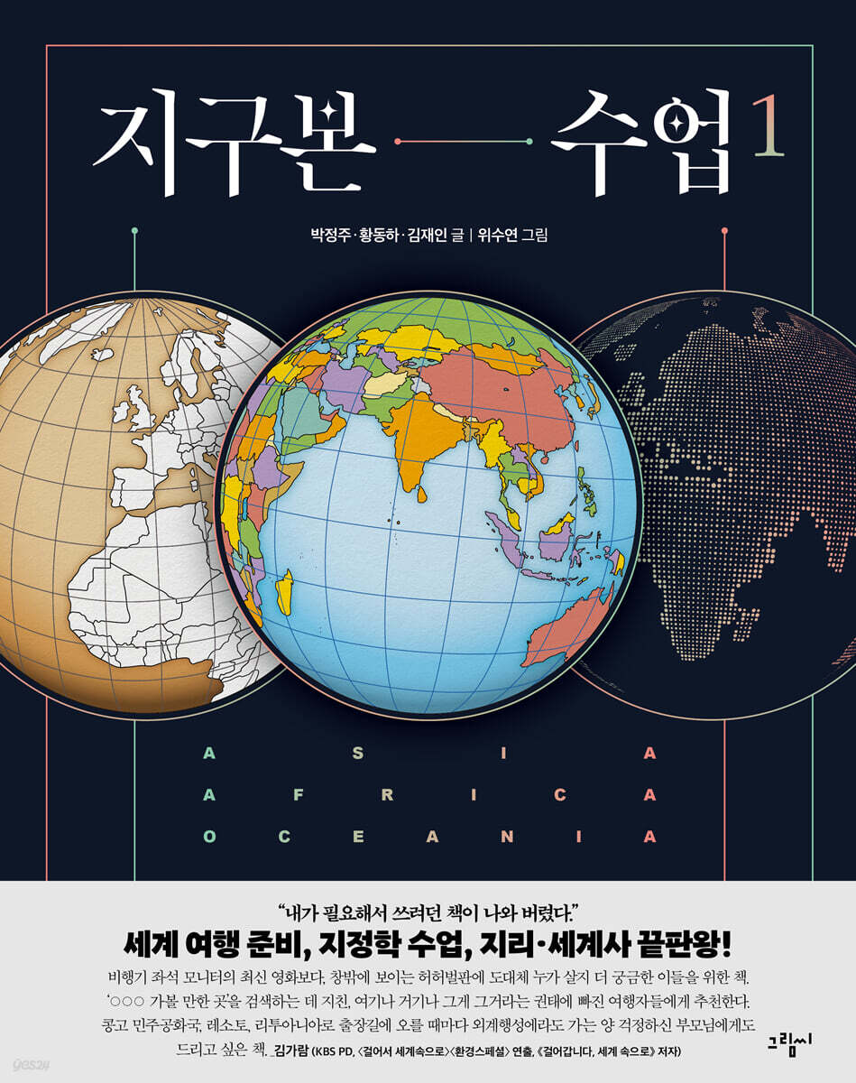
This book consists of Volume 1, which covers the continents of Asia, Africa, and Oceania, and Volume 2, which covers the continents of Europe, America, and Antarctica.
Rather than thick 'sticky notes' that are likely to be stuck in the house for decoration, it is intended to encourage people to open books more often and more easily.
Additionally, as it contains a vast amount of diverse data and information, a detailed 'index' that combines volumes 1 and 2 is included at the end of each volume, allowing you to quickly find the content you want at any time.
You can find the information you need not only by 'searching' by country or map, but also by reading the text and explanations of the illustrations.
Additionally, page numbers are included throughout the text to help you find other pages with related content.
Knowledge of integration spreads out like a panorama across the globe!
★ Includes over 200 colorful maps, including a vivid globe, and over 240 rich historical and cultural illustrations!
★'Core concepts of geography' such as revolution and rotation, continents and oceans, mountain ranges and lakes, latitude and longitude, the International Date Line and the Prime Meridian.
★From geography, history, politics, economy, culture, environment, and even GDP per capita across 203 countries across 6 continents!
★A time travel around the globe that spans human history, from the birth of Homo sapiens to the future world.
★Conflicts and conflicts around the world, key issues in diplomacy and geopolitics
★From the Ptolemaic world map to the Orsagraph projection, "Everything About Maps" for map enthusiasts.
★From the North Pole to the South Pole, Today's Earth Seen Through Environmental Issues
A groundbreaking globe class that surpasses 〈World Theme Travel〉, 〈The Power of Geography〉, and 〈World Report〉!
1.
Why a "globe"? Things you can't know without looking at a globe!
The greatest advantage of the world map we commonly use is that it allows us to see all of the Earth's land and sea at a glance.
But sometimes, when I look at a globe, I am surprised and think, “Is this country (or this ocean) this big? (or is it small?)”
Representative examples are ‘Greenland’ and ‘Pacific Ocean’.
Greenland (approximately 2,175,600 km²), located near the North Pole, is the world's largest island, but its area is significantly smaller than that of India (approximately 3,287,000 km²) or China (approximately 9,596,960 km²).
But on a world map, Greenland appears larger than India or China.
The same goes for the Pacific.
Although the Pacific Ocean is a very large ocean that covers about 34% of the Earth's surface area (about 165,246,000 km²), it does not appear to be that large on a world map compared to the Arctic or Southern Oceans.
Why is this? The fatal flaw of a flat world map is that it causes area distortion like this.
The closer you are to the equator, the smaller it appears, and the closer you are to the poles, the larger it appears in reality.
It's not just the distortion of area.
The flat world map has deeply distorted our sense of 'time/space' and 'distance'.
For example, there is the misconception that flights from South Korea to the United States cross the Pacific Ocean (in fact, they use the Arctic route), and the familiar notion that the world is centered around the Pacific Ocean, with Asia and America facing each other (in contrast, Europeans believe that Europe and America face each other with the Atlantic Ocean as the center).
However, if we look at it as a 'globe', this illusion cannot occur.
We quickly realize that it is much closer to fly through the North Pole than to fly east to west across the vast Pacific Ocean, and since the 'real' world has no 'center', our view can spread out in all directions.
Likewise, we can intuitively understand the time difference and distance difference of 'one day' across the International Date Line.
As the world's lands and seas are transferred to the globe, many new things are revealed.
The world seen through the globe is quite different from the world we have known so far.
After reading this book, your perspective on the world will change and the world will appear much more colorful.
2.
Includes over 440 rich illustrations, including the world's first globe illustration!
A book packed with in-depth knowledge on geography, history, politics, economics, culture, and environment from around the world!
To properly travel the globe, you need some prior knowledge.
To this end, we first present the core concepts of the Earth and geography, such as the Earth's revolution and rotation, continents and oceans, mountain ranges and lakes, latitude and longitude, the International Date Line and the Prime Meridian, in an easy and concise manner.
And the fascinating and diverse stories of the geography, history, politics, economy, culture, and environment of over 200 countries on Earth unfold like a panorama with over 440 illustrations (over 200 illustrations of globes and maps, and over 240 illustrations of history and culture).
In particular, the globe illustrations included in the book were personally created and included to show the three-dimensional perspective of this book.
Additionally, charts are provided throughout the country to provide basic information needed to understand each country at a glance, such as each country's flag, capital, area, religion, language, population, ethnic distribution, and GDP per capita.
In short, it provides a three-dimensional perspective that covers the entire globe, from past to present, and allows you to see everything from world history to geopolitics.
The way the content is described is also not a uniform structure as seen in general map books or geography books.
Like a multi-focus lens, it sometimes provides a detailed look into the interior of a country, and at other times reveals the interconnectedness of religions, cultural spheres, historical continuity, geopolitical issues, and environmental problems.
Furthermore, the book is packed to the brim with knowledge, from the 440 or so illustrations to the pop-up tips provided throughout, making it truly "thoroughly" filled with knowledge.
3.
Divided into two volumes for easy viewing, with a convenient 'Search' function to easily find the content you want.
This book consists of Volume 1, which covers the continents of Asia, Africa, and Oceania, and Volume 2, which covers the continents of Europe, America, and Antarctica.
Rather than thick 'sticky notes' that are likely to be stuck in the house for decoration, it is intended to encourage people to open books more often and more easily.
Additionally, as it contains a vast amount of diverse data and information, a detailed 'index' that combines volumes 1 and 2 is included at the end of each volume, allowing you to quickly find the content you want at any time.
You can find the information you need not only by 'searching' by country or map, but also by reading the text and explanations of the illustrations.
Additionally, page numbers are included throughout the text to help you find other pages with related content.
Knowledge of integration spreads out like a panorama across the globe!
★ Includes over 200 colorful maps, including a vivid globe, and over 240 rich historical and cultural illustrations!
★'Core concepts of geography' such as revolution and rotation, continents and oceans, mountain ranges and lakes, latitude and longitude, the International Date Line and the Prime Meridian.
★From geography, history, politics, economy, culture, environment, and even GDP per capita across 203 countries across 6 continents!
★A time travel around the globe that spans human history, from the birth of Homo sapiens to the future world.
★Conflicts and conflicts around the world, key issues in diplomacy and geopolitics
★From the Ptolemaic world map to the Orsagraph projection, "Everything About Maps" for map enthusiasts.
★From the North Pole to the South Pole, Today's Earth Seen Through Environmental Issues
GOODS SPECIFICS
- Date of issue: September 10, 2024
- Page count, weight, size: 268 pages | 674g | 190*240*17mm
- ISBN13: 9791189231590
- ISBN10: 118923159X
You may also like
카테고리
korean


korean

![ELLE 엘르 스페셜 에디션 A형 : 12월 [2025]](http://librairie.coreenne.fr/cdn/shop/files/b8e27a3de6c9538896439686c6b0e8fb.jpg?v=1766436872&width=3840)


