

A map of the world at a glance
 |
Description
Book Introduction
“A story that depicts the uncomfortable truth of today’s world without distortion.
“The best geography textbook of our time”
From environmental pollution to social inequality, war, and space exploration.
A powerful visual insight into the crises and challenges facing Earth and human civilization!
★ Praised by world-renowned media outlets such as Le Monde and Le Figaro
★ Korea's first publication, 'World Geography in Two Hemispheres'
★ A masterpiece by the winner of the 'Malopier Awards', the most prestigious media award in the world.
When we explore different parts of the world, we often turn to Google Maps.
Some people think that all you have to do is unfold a paper map or spin a globe.
But is the Earth we see on those familiar maps really the Earth? World maps drawn on flat surfaces or spheres inevitably suffer from distortions in area and shape.
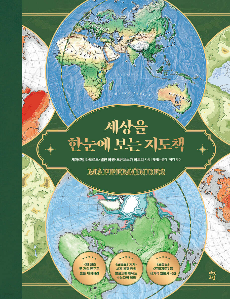
So, is there no way to see the Earth as it really is? The map that clearly solves this problem is the "hemisphere" map.
To create a map as close to reality as possible, the authors, a journalist for Le Monde, a Malofiet Award-winning cartographer, and a geopolitical expert, present an innovative work called "The World at a Glance."
It shows the true world geography with the least distortion by connecting two circles, or hemispheres, that divide the world in half.
The problem with the modern maps we are familiar with is not just the distortion of shape and area.
The hemispheric world map, which can be considered the original form of a map, clearly shows how narrow-minded our perspective has been.
The fact that various cartographic methods, such as hemispheric maps, have been forgotten as a result of the use of uniform maps based on Google Maps shows that the way we represent the world today is becoming impoverished.
Also, unlike a globe, the two circles simultaneously show the Earth without hiding any side, reminding us that the center of the world could be Asia, Antarctica, or the Pacific, rather than Europe or the United States.
Maps are the most intuitive and powerful tool for viewing the world.
A hemispherical map changes your perspective on the world.
In today's world, where understanding how humans connect with their environment and how they influence one another has become crucial, this book, which allows us to face the truth of the world from a broader perspective, free from misunderstandings and prejudices, is arguably the best educational book of our time.
“The best geography textbook of our time”
From environmental pollution to social inequality, war, and space exploration.
A powerful visual insight into the crises and challenges facing Earth and human civilization!
★ Praised by world-renowned media outlets such as Le Monde and Le Figaro
★ Korea's first publication, 'World Geography in Two Hemispheres'
★ A masterpiece by the winner of the 'Malopier Awards', the most prestigious media award in the world.
When we explore different parts of the world, we often turn to Google Maps.
Some people think that all you have to do is unfold a paper map or spin a globe.
But is the Earth we see on those familiar maps really the Earth? World maps drawn on flat surfaces or spheres inevitably suffer from distortions in area and shape.
So, is there no way to see the Earth as it really is? The map that clearly solves this problem is the "hemisphere" map.
To create a map as close to reality as possible, the authors, a journalist for Le Monde, a Malofiet Award-winning cartographer, and a geopolitical expert, present an innovative work called "The World at a Glance."
It shows the true world geography with the least distortion by connecting two circles, or hemispheres, that divide the world in half.
The problem with the modern maps we are familiar with is not just the distortion of shape and area.
The hemispheric world map, which can be considered the original form of a map, clearly shows how narrow-minded our perspective has been.
The fact that various cartographic methods, such as hemispheric maps, have been forgotten as a result of the use of uniform maps based on Google Maps shows that the way we represent the world today is becoming impoverished.
Also, unlike a globe, the two circles simultaneously show the Earth without hiding any side, reminding us that the center of the world could be Asia, Antarctica, or the Pacific, rather than Europe or the United States.
Maps are the most intuitive and powerful tool for viewing the world.
A hemispherical map changes your perspective on the world.
In today's world, where understanding how humans connect with their environment and how they influence one another has become crucial, this book, which allows us to face the truth of the world from a broader perspective, free from misunderstandings and prejudices, is arguably the best educational book of our time.
- You can preview some of the book's contents.
Preview
index
Chapter 1.
A hemispheric world map that traces the pulse of the Earth
*The era of the Anthropocene
1.
Point Nemo: Far from It All
2.
Blue line: Earth's vascular system
3.
Green Canopy: Overall Forest Condition
4.
A tangled hemispherical world map: The movement of the wind
5.
Raster of the Wind: The Power of the Wind
6.
Surfing Hemisphere World Map: The Power of the Sea
7.
Breathing the Earth: A Year in the Hemispheric World Map
8.
Geological Hemisphere World Map: Paleogeography
9.
Vibrating Hemisphere World Map: Seismic Energy
[Turkey and Syria] The highest-intensity earthquake ever observed on the East Anatolian Fault.
10.
Broken Thermometer: Isothermal Hemispheric World Map
[Mediterranean Sea] Sea waters are becoming increasingly abnormally warm.
11.
Dionysus' Hemispheric World Map: A New Winery Landscape
12.
A submerged hemisphere world map: If all the world's ice melted
13.
Island Hemisphere World Map: A World Tour of Island Exploration
14.
A Cracked Hemisphere World Map: When Glaciers Collapse
Chapter 2.
A hemispheric world map that captures the pulse of Earth's inhabitants
*8 billion people live on only one Earth
15.
8 Billion People on Earth: The Challenge of Population Growth
16.
Human Activity Network: A Hemispheric World Map in the Shape of a Mesh
17.
The Shifting Hemisphere World Map: Key Causes of Conflict and Catastrophe
18.
A Hemispheric World Map of Fisheries: Overfishing Threatens the Oceans
19.
Coughing Hemisphere World Map: Greenhouse Gases and Air Pollution
20.
A World Map of Plastic-Covered Hemispheres: Polluted Rivers and Oceans
21.
A Map of the Impoverished Hemisphere: Biodiversity Under Threat
Chapter 3.
A hemispheric world map that traces the pulse of human society
*The lines that divide the world
22.
A Hemispheric Map of Misogyny: A World Still Unequal
23. LGBTQIA+: A Map of the Oppressed Alphabet Letters
24.
A Map of the Gagged Hemispheres: The State of Press Freedom Around the World
25.
A World Map of Hemispheres in Disarray: Borders and Barriers That Divide the World
26.
A Warlike Hemisphere World Map: A World Where Wars Still Occur
[Ukraine] A new epicenter of violence
27.
A Closely Connected Hemispheric World Map: GAFAM Power and State Control
28.
Peace-Seeking Mine Clearance Warrior: A Fantasy World Map That Changes the World
Chapter 4.
A hemispheric world map that went into space
*Is Earth a blue planet or just a small, weak marble?
29.
A Hemispherical World Map in Space: Nebulae Created by Satellites
30.
Red Planet: A Crimson Hemisphere World Map
31.
Map of the Moon's Hemispheres: Earth's Satellite, the Moon
32.
A Hemispherical Universe at Scale: Tiny Dots in the Solar System
33.
The Sleepless Hemisphere World Map: A Night Sky Unlit by Artificial Light
[Syria and Iraq] When the Lights Go Out in War
Chapter 5.
A Hemispherical World Map Under a Microscope: Principles of Mapmaking
*From Beheim's Globe to Google Maps
34.
A tricky world map: neither perfectly flat nor perfectly spherical.
35.
Tissot Ellipse: Various Types of Hemispherical World Maps
36.
OpenStreetMap: Participatory Mapmaking
37.
The Inverted Hemisphere World Map: Misunderstanding Semiotics
38.
Antipodal Hemispheric World Map: Seeing the World Upside Down
39.
Terra Nullius: On the Importance of Base Maps
40.
Tanaka's Hemispheric World Map: The Allure of Ups and Downs
[Switzerland] Support for the Green Region in the Eduard Imhof Way
[Japan] Local support drawn in the style of Kichiro Tanaka
41.
Ocumene's Hemispheric World Map: The Outlines Grow Clearer
Acknowledgements
Reviewer's note
References
About the Author
A hemispheric world map that traces the pulse of the Earth
*The era of the Anthropocene
1.
Point Nemo: Far from It All
2.
Blue line: Earth's vascular system
3.
Green Canopy: Overall Forest Condition
4.
A tangled hemispherical world map: The movement of the wind
5.
Raster of the Wind: The Power of the Wind
6.
Surfing Hemisphere World Map: The Power of the Sea
7.
Breathing the Earth: A Year in the Hemispheric World Map
8.
Geological Hemisphere World Map: Paleogeography
9.
Vibrating Hemisphere World Map: Seismic Energy
[Turkey and Syria] The highest-intensity earthquake ever observed on the East Anatolian Fault.
10.
Broken Thermometer: Isothermal Hemispheric World Map
[Mediterranean Sea] Sea waters are becoming increasingly abnormally warm.
11.
Dionysus' Hemispheric World Map: A New Winery Landscape
12.
A submerged hemisphere world map: If all the world's ice melted
13.
Island Hemisphere World Map: A World Tour of Island Exploration
14.
A Cracked Hemisphere World Map: When Glaciers Collapse
Chapter 2.
A hemispheric world map that captures the pulse of Earth's inhabitants
*8 billion people live on only one Earth
15.
8 Billion People on Earth: The Challenge of Population Growth
16.
Human Activity Network: A Hemispheric World Map in the Shape of a Mesh
17.
The Shifting Hemisphere World Map: Key Causes of Conflict and Catastrophe
18.
A Hemispheric World Map of Fisheries: Overfishing Threatens the Oceans
19.
Coughing Hemisphere World Map: Greenhouse Gases and Air Pollution
20.
A World Map of Plastic-Covered Hemispheres: Polluted Rivers and Oceans
21.
A Map of the Impoverished Hemisphere: Biodiversity Under Threat
Chapter 3.
A hemispheric world map that traces the pulse of human society
*The lines that divide the world
22.
A Hemispheric Map of Misogyny: A World Still Unequal
23. LGBTQIA+: A Map of the Oppressed Alphabet Letters
24.
A Map of the Gagged Hemispheres: The State of Press Freedom Around the World
25.
A World Map of Hemispheres in Disarray: Borders and Barriers That Divide the World
26.
A Warlike Hemisphere World Map: A World Where Wars Still Occur
[Ukraine] A new epicenter of violence
27.
A Closely Connected Hemispheric World Map: GAFAM Power and State Control
28.
Peace-Seeking Mine Clearance Warrior: A Fantasy World Map That Changes the World
Chapter 4.
A hemispheric world map that went into space
*Is Earth a blue planet or just a small, weak marble?
29.
A Hemispherical World Map in Space: Nebulae Created by Satellites
30.
Red Planet: A Crimson Hemisphere World Map
31.
Map of the Moon's Hemispheres: Earth's Satellite, the Moon
32.
A Hemispherical Universe at Scale: Tiny Dots in the Solar System
33.
The Sleepless Hemisphere World Map: A Night Sky Unlit by Artificial Light
[Syria and Iraq] When the Lights Go Out in War
Chapter 5.
A Hemispherical World Map Under a Microscope: Principles of Mapmaking
*From Beheim's Globe to Google Maps
34.
A tricky world map: neither perfectly flat nor perfectly spherical.
35.
Tissot Ellipse: Various Types of Hemispherical World Maps
36.
OpenStreetMap: Participatory Mapmaking
37.
The Inverted Hemisphere World Map: Misunderstanding Semiotics
38.
Antipodal Hemispheric World Map: Seeing the World Upside Down
39.
Terra Nullius: On the Importance of Base Maps
40.
Tanaka's Hemispheric World Map: The Allure of Ups and Downs
[Switzerland] Support for the Green Region in the Eduard Imhof Way
[Japan] Local support drawn in the style of Kichiro Tanaka
41.
Ocumene's Hemispheric World Map: The Outlines Grow Clearer
Acknowledgements
Reviewer's note
References
About the Author
Detailed image

Into the book
I find the hemispherical world map fascinating because it reminds us that the Earth is round, while simultaneously showing us all sides of the Earth without hiding any of them, unlike a globe.
…I sincerely hope that this book will open up a new perspective on the world for Korean readers.
And I hope this will be an opportunity to reflect on the means to create a more sustainable and equitable future for the entire planet.
--- From "To Korean Readers"
In the middle of the Pacific Ocean is 'Point Nemo'.
The name is derived from the name of the captain of the Nautilus in Jules Verne's novel Twenty Thousand Leagues Under the Sea.
Point Nemo is the point in the ocean farthest from any land on Earth.
It is located more than 2,700 kilometers from the Antarctic coast and Easter Island, and more than 4,000 kilometers from the coasts of New Zealand and Chile.
The coordinates of Point Nemo, as accurately calculated in 1992, are 48 degrees south latitude, 123 degrees west longitude (48˚ 52′ 32″ S, 123˚ 23′ 33″ O).
--- From "Chapter 1 'Point Nemo'"
“Just as history is geography in time, geography is history in space.” (Elise Reclus, Man and the Earth, 1905)
--- From Chapter 2, “8 Billion People Live on Only One Earth”
There is now almost no uninhabited land on Earth, called 'terra nullius'.
Today, however, there are over 300 international borders, totaling over 261,000 kilometers (if you connected all the borders together, you could circle the Earth six and a half times!).
--- From Chapter 3, “Lines that Divide the World”
This one photo also brought home to us a new awareness of how fragile our planet is.
It is no coincidence that the Earth is called a blue 'marble' rather than a blue 'ball' because of the color of the oceans.
What this means is that the Earth has been confirmed as a tiny object in the vastness of the universe, a pitiful object floating alone in “the blackest, deepest darkness that the human eye can perceive,” to borrow the words of Eugene Cernan, who led the Apollo program in 1972.
--- From Chapter 4, "Is Earth a Blue Planet or Just a Small, Weak Bead?"
Now, thanks to our cell phones, we all have the globe in our hands.
While we can now freely draw our position closer and further away from the entire globe, from the street where our house is located, we unfortunately do not perform the almost gymnastic movements of repeatedly unfolding and refolding the famous maps published by the Institut National de Geography of France.
--- From Chapter 5, "From Beheim's Globe to Google Maps"
The book is very beautiful.
Not only is it aesthetically valuable, but its content is also rich.
I am sure that for anyone who wants to know about the changing world, this will be a book that they will keep opening until the spine becomes worn.
…I sincerely hope that this book will open up a new perspective on the world for Korean readers.
And I hope this will be an opportunity to reflect on the means to create a more sustainable and equitable future for the entire planet.
--- From "To Korean Readers"
In the middle of the Pacific Ocean is 'Point Nemo'.
The name is derived from the name of the captain of the Nautilus in Jules Verne's novel Twenty Thousand Leagues Under the Sea.
Point Nemo is the point in the ocean farthest from any land on Earth.
It is located more than 2,700 kilometers from the Antarctic coast and Easter Island, and more than 4,000 kilometers from the coasts of New Zealand and Chile.
The coordinates of Point Nemo, as accurately calculated in 1992, are 48 degrees south latitude, 123 degrees west longitude (48˚ 52′ 32″ S, 123˚ 23′ 33″ O).
--- From "Chapter 1 'Point Nemo'"
“Just as history is geography in time, geography is history in space.” (Elise Reclus, Man and the Earth, 1905)
--- From Chapter 2, “8 Billion People Live on Only One Earth”
There is now almost no uninhabited land on Earth, called 'terra nullius'.
Today, however, there are over 300 international borders, totaling over 261,000 kilometers (if you connected all the borders together, you could circle the Earth six and a half times!).
--- From Chapter 3, “Lines that Divide the World”
This one photo also brought home to us a new awareness of how fragile our planet is.
It is no coincidence that the Earth is called a blue 'marble' rather than a blue 'ball' because of the color of the oceans.
What this means is that the Earth has been confirmed as a tiny object in the vastness of the universe, a pitiful object floating alone in “the blackest, deepest darkness that the human eye can perceive,” to borrow the words of Eugene Cernan, who led the Apollo program in 1972.
--- From Chapter 4, "Is Earth a Blue Planet or Just a Small, Weak Bead?"
Now, thanks to our cell phones, we all have the globe in our hands.
While we can now freely draw our position closer and further away from the entire globe, from the street where our house is located, we unfortunately do not perform the almost gymnastic movements of repeatedly unfolding and refolding the famous maps published by the Institut National de Geography of France.
--- From Chapter 5, "From Beheim's Globe to Google Maps"
The book is very beautiful.
Not only is it aesthetically valuable, but its content is also rich.
I am sure that for anyone who wants to know about the changing world, this will be a book that they will keep opening until the spine becomes worn.
--- From "The Supervisor's Note"
Publisher's Review
★ The only book that examines the latest issues regarding the Earth and humanity from a global perspective.
★ The latest work by the winner of the Pulitzer Prize-winning 'Malopier Graphics Award' in the infographics field.
★ Includes over 50 problematic maps carefully selected by Le Monde journalists and geopolitical experts.
★ A 'two-circle hemispheric world map' that overcomes the distortion of the globe and the limitations of flat maps.
★ A full-color, gold-leafed, four-season hardcover edition that best reproduces the artistic and scientific French original.
“The map you knew all along was wrong!”
― The surprising truth about maps that completely overturn our distorted worldview.
When we explore different parts of the world, we often turn to Google Maps.
Some people think that all you have to do is unfold a paper map or spin a globe.
But is the Earth we see on those familiar maps really the Earth? World maps drawn on flat surfaces or spheres inevitably suffer from distortions in area and shape.
So, is there no way to see the Earth as it really is? The map that clearly solves this problem is the "hemisphere" map.
To create a map as close to reality as possible, the authors, who are journalists for Le Monde, award-winning cartographers, and geopolitical experts, present the innovative result of "The World at a Glance".
It shows the true world geography with the least distortion by connecting two circles, or hemispheres, that divide the world in half.
The hemispheric world map is actually a map with a long tradition.
As navigation and printing technology developed and the creators' goals became stronger, maps gradually became simpler, more useful, and more modern.
On the other hand, the hemispheric world map, which clearly shows the original appearance of the map, has the characteristic of presenting an overwhelming amount of information, such as diagrams, scales, and reference points that change every time, in an aesthetically pleasing and clearly organized structure.
However, the reason why 『Atlas of the World at a Glance』 can be considered the first innovative attempt is because it is a creative work that presents powerful visual insights by unfolding the most up-to-date data, such as numbers and statistics that describe us today, on top of the old traditional map.
It created an unprecedented map that allowed the world to be viewed and compared at the same scale and size, regardless of subject.
“50 Visual Storytelling Tips to Understand the World at a Glance!”
― A powerful tool to face the present and confront future crises.
The book, "A Map of the World at a Glance," contains a total of 50 maps, including 41 thematic maps.
Each map, covering virtually every major issue in the world, presents a panoramic display of overwhelming data from a wide range of fields, including geography, climatology, biology, history, and sociology.
These maps allow readers to get a comprehensive view of the world we live in, while also examining its minute details.
The maps, which implement physical geographic data such as the current state of the Earth's forests, including disappearing tropical rainforests, the distribution of melting glaciers, and even the location of plastic waste in the ocean being polluted by plastic, are, as the editor Professor Park Kyung said, "showcase the severity of the sharp problems of the Anthropocene in three dimensions, and are in themselves excellent earth science textbooks."
Moreover, humanistic maps based on the latest statistical data, such as maps visualizing the degree of women's inequality and freedom of the press in each country around the world, and maps showing the migration routes and death toll of people displaced by war, show the current state of human civilization.
The moment the increasingly serious global warming, destruction of nature, and the discordant human society that shows no signs of improving unfold on a single hemispheric map, we finally realize that the world's various problems are directly connected to our own "future" and are interconnected.
The map's visual storytelling about the crisis facing humanity speaks more powerfully than any words can: the challenge before us is one we must address with our own hands.
“The wonder of a map that so exquisitely depicts today’s world!” (Le Monde)
― A brilliant masterpiece recognized by the world's leading media, publishing, and academic circles.
The book, "A Map of the World at a Glance," has received rave reviews from leading international media, publishing, and academic circles.
Le Monde praised it as “a marvel that exquisitely depicts today’s world,” while Le Figaro praised it as “a great work that demonstrates the importance of geography,” and L’Express praised it as “capturing both aesthetics and culture.”
This is also because it is a book that was created with the expertise and effort of author Semartin Laborde, winner of the Malopier International Infographics Award, which is called the Pulitzer Prize of the infographics field, and Delphine Papin and Francesca Fattori, renowned geopolitical experts and journalists for Le Monde.
The reason it received such acclaim is likely due to the fact that it was produced in France, a country known for its pride in mapmaking, but it is also because they recognize the importance of a truly well-made map.
The importance of maps has never been overlooked since their inception.
Especially today, the world is more closely and complexly connected than at any time in human history.
The ongoing wars in Eastern Europe and the Middle East, as well as the disappearance of the Amazon rainforest, cannot be dismissed as mere "foreign topics," because everything that happens on Earth will eventually circle around and affect everyone.
Overfishing and ocean pollution will soon change what's for dinner, and rising global temperatures are forcing us to say goodbye to France's Bordeaux wine.
The wars that are happening everywhere are also coming back to me as problems such as rising oil prices and price instability.
The world has been ruled by those who have the map for a very long time.
While geographic data is readily accessible to everyone today, map literacy remains a relatively small minority, meaning those who understand and utilize geography will always have an advantage.
This book, which fosters geographic literacy that allows readers to see the world more broadly and deeply, is expected to have a positive impact on Korea, a country destined for a "geopolitical chokepoint" in this turbulent era.
★ The latest work by the winner of the Pulitzer Prize-winning 'Malopier Graphics Award' in the infographics field.
★ Includes over 50 problematic maps carefully selected by Le Monde journalists and geopolitical experts.
★ A 'two-circle hemispheric world map' that overcomes the distortion of the globe and the limitations of flat maps.
★ A full-color, gold-leafed, four-season hardcover edition that best reproduces the artistic and scientific French original.
“The map you knew all along was wrong!”
― The surprising truth about maps that completely overturn our distorted worldview.
When we explore different parts of the world, we often turn to Google Maps.
Some people think that all you have to do is unfold a paper map or spin a globe.
But is the Earth we see on those familiar maps really the Earth? World maps drawn on flat surfaces or spheres inevitably suffer from distortions in area and shape.
So, is there no way to see the Earth as it really is? The map that clearly solves this problem is the "hemisphere" map.
To create a map as close to reality as possible, the authors, who are journalists for Le Monde, award-winning cartographers, and geopolitical experts, present the innovative result of "The World at a Glance".
It shows the true world geography with the least distortion by connecting two circles, or hemispheres, that divide the world in half.
The hemispheric world map is actually a map with a long tradition.
As navigation and printing technology developed and the creators' goals became stronger, maps gradually became simpler, more useful, and more modern.
On the other hand, the hemispheric world map, which clearly shows the original appearance of the map, has the characteristic of presenting an overwhelming amount of information, such as diagrams, scales, and reference points that change every time, in an aesthetically pleasing and clearly organized structure.
However, the reason why 『Atlas of the World at a Glance』 can be considered the first innovative attempt is because it is a creative work that presents powerful visual insights by unfolding the most up-to-date data, such as numbers and statistics that describe us today, on top of the old traditional map.
It created an unprecedented map that allowed the world to be viewed and compared at the same scale and size, regardless of subject.
“50 Visual Storytelling Tips to Understand the World at a Glance!”
― A powerful tool to face the present and confront future crises.
The book, "A Map of the World at a Glance," contains a total of 50 maps, including 41 thematic maps.
Each map, covering virtually every major issue in the world, presents a panoramic display of overwhelming data from a wide range of fields, including geography, climatology, biology, history, and sociology.
These maps allow readers to get a comprehensive view of the world we live in, while also examining its minute details.
The maps, which implement physical geographic data such as the current state of the Earth's forests, including disappearing tropical rainforests, the distribution of melting glaciers, and even the location of plastic waste in the ocean being polluted by plastic, are, as the editor Professor Park Kyung said, "showcase the severity of the sharp problems of the Anthropocene in three dimensions, and are in themselves excellent earth science textbooks."
Moreover, humanistic maps based on the latest statistical data, such as maps visualizing the degree of women's inequality and freedom of the press in each country around the world, and maps showing the migration routes and death toll of people displaced by war, show the current state of human civilization.
The moment the increasingly serious global warming, destruction of nature, and the discordant human society that shows no signs of improving unfold on a single hemispheric map, we finally realize that the world's various problems are directly connected to our own "future" and are interconnected.
The map's visual storytelling about the crisis facing humanity speaks more powerfully than any words can: the challenge before us is one we must address with our own hands.
“The wonder of a map that so exquisitely depicts today’s world!” (Le Monde)
― A brilliant masterpiece recognized by the world's leading media, publishing, and academic circles.
The book, "A Map of the World at a Glance," has received rave reviews from leading international media, publishing, and academic circles.
Le Monde praised it as “a marvel that exquisitely depicts today’s world,” while Le Figaro praised it as “a great work that demonstrates the importance of geography,” and L’Express praised it as “capturing both aesthetics and culture.”
This is also because it is a book that was created with the expertise and effort of author Semartin Laborde, winner of the Malopier International Infographics Award, which is called the Pulitzer Prize of the infographics field, and Delphine Papin and Francesca Fattori, renowned geopolitical experts and journalists for Le Monde.
The reason it received such acclaim is likely due to the fact that it was produced in France, a country known for its pride in mapmaking, but it is also because they recognize the importance of a truly well-made map.
The importance of maps has never been overlooked since their inception.
Especially today, the world is more closely and complexly connected than at any time in human history.
The ongoing wars in Eastern Europe and the Middle East, as well as the disappearance of the Amazon rainforest, cannot be dismissed as mere "foreign topics," because everything that happens on Earth will eventually circle around and affect everyone.
Overfishing and ocean pollution will soon change what's for dinner, and rising global temperatures are forcing us to say goodbye to France's Bordeaux wine.
The wars that are happening everywhere are also coming back to me as problems such as rising oil prices and price instability.
The world has been ruled by those who have the map for a very long time.
While geographic data is readily accessible to everyone today, map literacy remains a relatively small minority, meaning those who understand and utilize geography will always have an advantage.
This book, which fosters geographic literacy that allows readers to see the world more broadly and deeply, is expected to have a positive impact on Korea, a country destined for a "geopolitical chokepoint" in this turbulent era.
GOODS SPECIFICS
- Date of issue: January 31, 2025
- Format: Hardcover book binding method guide
- Page count, weight, size: 156 pages | 1,102g | 230*300*20mm
- ISBN13: 9791130660813
- ISBN10: 1130660818
You may also like
카테고리
korean


korean

![GQ KOREA Mark (Monthly): December [2025]](http://librairie.coreenne.fr/cdn/shop/files/8ef265dbbfbf186523ed75ba7319009d.jpg?v=1765340328&width=3840)


