

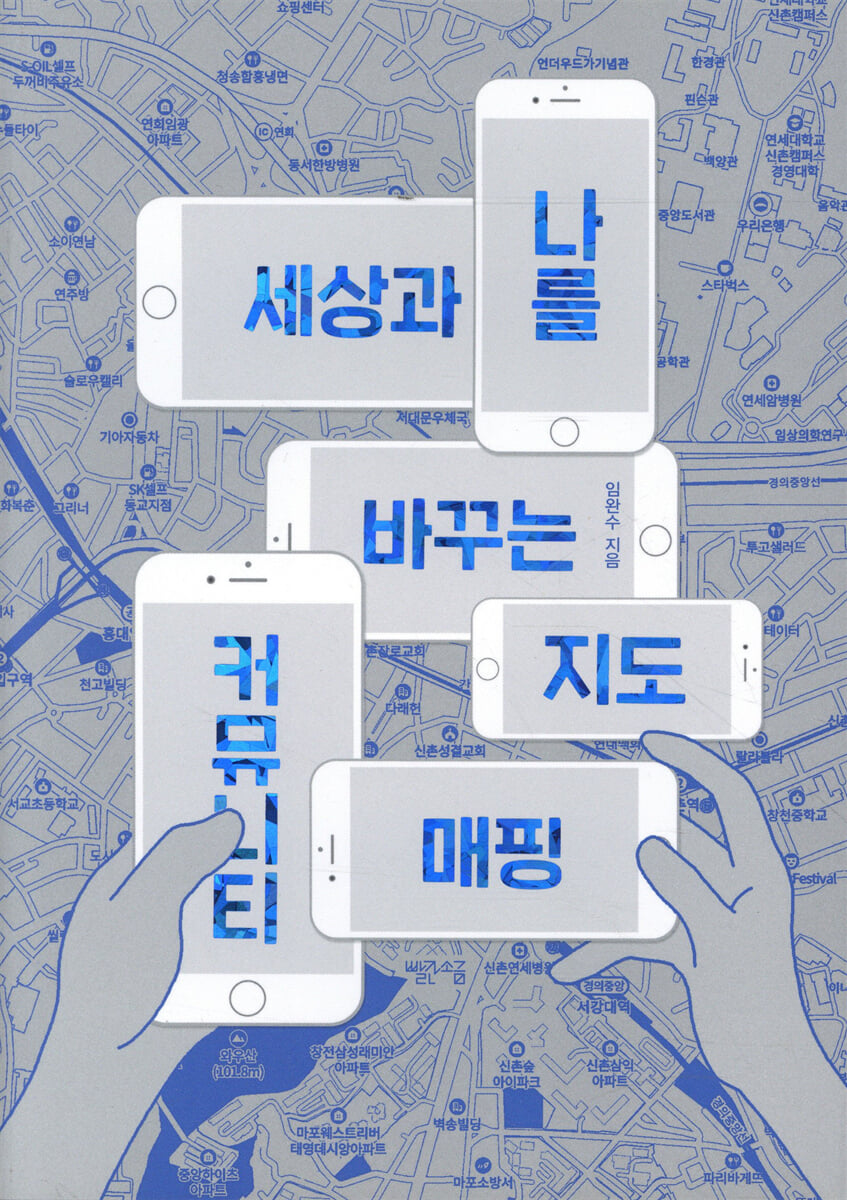
Community Mapping: A Map That Changes the World and Me
 |
Description
Book Introduction
Professor Lim Wan-su, a pioneer in community mapping, speaks
Everything about community mapping!
Community Mapping is literally ‘creating a community map.’
Author Im Wan-su is often referred to as the 'pioneer of community mapping.'
The 'New York Restroom Online Map' he created in 2005 using collective intelligence is considered a pioneering model of community mapping.
This activity attracted attention, being featured in [The New Yorker], [The New York Times], and [15 Minutes to Change the World].
Additionally, the 'Gas Station Map' created with high school students during Hurricane Sandy, which hit the northeastern United States in 2012, was so influential that it was used by the Federal Emergency Management Agency, Google, New York City, and the White House.
This book contains everything about community mapping that Professor Lim Wan-su has been researching and developing with citizens.
This can be considered the first complete textbook on community mapping.
Community mapping is currently being embraced globally as a tool for social innovation, linked to citizen science and living labs.
It is also actively utilized by local governments, village communities, and schools of all levels in Korea.
However, there are many examples where the focus is on 'map making' and ends up as a one-time event focused on results.
The most important value in community mapping is ‘togetherness.’
Therefore, ‘organization of the process’ is important.
This book uses vivid examples to remind us of the inherent value of recent community mapping activities, which can easily be overlooked.
Everything about community mapping!
Community Mapping is literally ‘creating a community map.’
Author Im Wan-su is often referred to as the 'pioneer of community mapping.'
The 'New York Restroom Online Map' he created in 2005 using collective intelligence is considered a pioneering model of community mapping.
This activity attracted attention, being featured in [The New Yorker], [The New York Times], and [15 Minutes to Change the World].
Additionally, the 'Gas Station Map' created with high school students during Hurricane Sandy, which hit the northeastern United States in 2012, was so influential that it was used by the Federal Emergency Management Agency, Google, New York City, and the White House.
This book contains everything about community mapping that Professor Lim Wan-su has been researching and developing with citizens.
This can be considered the first complete textbook on community mapping.
Community mapping is currently being embraced globally as a tool for social innovation, linked to citizen science and living labs.
It is also actively utilized by local governments, village communities, and schools of all levels in Korea.
However, there are many examples where the focus is on 'map making' and ends up as a one-time event focused on results.
The most important value in community mapping is ‘togetherness.’
Therefore, ‘organization of the process’ is important.
This book uses vivid examples to remind us of the inherent value of recent community mapping activities, which can easily be overlooked.
- You can preview some of the book's contents.
Preview
index
Entering
Part 1: What is Community Mapping?
1.
The process of co-producing information
2.
The process of creating a map and sharing information gathered by multiple people
3.
The process of becoming an information prosumer
Part 2: How Community Mapping Works
4.
Framework
5.
Components
Community | Communication through Participation | Map | Create
6.
process
Pre-planning | Community mapping training | Workshops | Map creation and presentation | Data analysis and sharing of findings | Generating ideas for local improvement | Implementation and evaluation
7.
Expected effect
Efficiency, Effectiveness, Equity | Education, Participation, Capacity Building
8.
value
Participation | Communication | Empathy | Consideration | Volunteering and Collective Intelligence
Part 3: Community Mapping: A Deeper Look
9. Some functions of GIS
Data Visualization and Proximity Assessment | Overlays | Connectivity | Change Detection Monitoring | Spatial Modeling
10.
Examples of citizen participation
Seoul City's Sungdeok Elementary School's "Safe School Routes" Mapping Project | Bucheon City's Songnae High School's "Disaster Risk and Fine Dust" Mapping Project | Seoul City's Magok District's Odor Community Mapping | Community Mapping Requiring Temporary and Accurate Data Measurement
11.
Citizen Science, Living Labs, and Community Mapping
What is Citizen Science? | What is a Living Lab? | The Core Elements of a Living Lab | The Joyful Interplay of Community Mapping and Living Labs
Part 4: Community Mapping for a Sustainable Society
12.
Community Mapping and Utilization of Public Data
Enhancing transparency and accountability in local governments | Increasing access to government services and expanding resident participation | Strengthening local capacity | Expanding new service offerings | Creating innovation | Improving the efficiency of government services | Improving the effectiveness of public institutions
13.
Creating public information together
14.
Standards for information sharing
Going out
Part 1: What is Community Mapping?
1.
The process of co-producing information
2.
The process of creating a map and sharing information gathered by multiple people
3.
The process of becoming an information prosumer
Part 2: How Community Mapping Works
4.
Framework
5.
Components
Community | Communication through Participation | Map | Create
6.
process
Pre-planning | Community mapping training | Workshops | Map creation and presentation | Data analysis and sharing of findings | Generating ideas for local improvement | Implementation and evaluation
7.
Expected effect
Efficiency, Effectiveness, Equity | Education, Participation, Capacity Building
8.
value
Participation | Communication | Empathy | Consideration | Volunteering and Collective Intelligence
Part 3: Community Mapping: A Deeper Look
9. Some functions of GIS
Data Visualization and Proximity Assessment | Overlays | Connectivity | Change Detection Monitoring | Spatial Modeling
10.
Examples of citizen participation
Seoul City's Sungdeok Elementary School's "Safe School Routes" Mapping Project | Bucheon City's Songnae High School's "Disaster Risk and Fine Dust" Mapping Project | Seoul City's Magok District's Odor Community Mapping | Community Mapping Requiring Temporary and Accurate Data Measurement
11.
Citizen Science, Living Labs, and Community Mapping
What is Citizen Science? | What is a Living Lab? | The Core Elements of a Living Lab | The Joyful Interplay of Community Mapping and Living Labs
Part 4: Community Mapping for a Sustainable Society
12.
Community Mapping and Utilization of Public Data
Enhancing transparency and accountability in local governments | Increasing access to government services and expanding resident participation | Strengthening local capacity | Expanding new service offerings | Creating innovation | Improving the efficiency of government services | Improving the effectiveness of public institutions
13.
Creating public information together
14.
Standards for information sharing
Going out
Into the book
The information is not really that grand.
The little things we know come together to form big data.
Things like what time our neighborhood supermarket opens, the owner of a certain store comes out every morning at 9:00 to sweep the front of the store with a broom, or which school has a lot of children waiting at the bus stop at 8:20 in the morning—all of these things become geographic information.
Nowadays, the term big data is used a lot in various places.
It is easy to understand that collecting a lot of data creates big data.
This statement is both true and false.
This is because we need to ask the question of whether collecting a lot of information will make it all useful information.
Information becomes information only when it is used properly where it is needed.
If you just collect it, it may become garbage rather than information.
--- pp.22-23
Community mapping is often interpreted as ‘creating a community map.’
The important thing here is to create ‘together’.
Community implies action together.
Therefore, the term community map is somewhat inadequate, so the English term community mapping is used.
If I had to translate it into Korean, it would be something like ‘a community map we create together.’
You might ask how we put the map together.
“Isn’t that something that experts do?”
“Can you make something without even knowing how to accumulate maps?”
In the past, you couldn't make a map unless you were an expert.
However, with various map-related tools, including Google, being made available to the general public for free, it has become possible to create maps together and easily.
This happened after the 2000s.
--- p.24
Online maps have become available, enabling multiple people to move simultaneously, collect and share information using not only computers but also smartphones.
With the advancement of technology, the concept of community mapping has become better defined and activated.
Community mapping, in a nutshell, is a knowledge-sharing method based on geographic information, made possible by the advancement of location-based information systems and web- and mobile-based information and communication technologies. It is the realization of positive values that can be driven by collective intelligence.
For residents left stranded by Hurricane Sandy without access to gas, the student-collected gas station information proved vital.
And the maps created in this way spread far and wide and exerted their power.
--- pp.30-31
There are countless examples of community mapping leading to or initiating living labs.
Living Labs can only be more effective when they directly connect community mapping to policy, rather than treating it as a one-time event.
There has been no example in Korea of this tool being actively utilized and reflected in administration and sustained.
Although there have been several attempts, there have often been structural problems such as a lack of understanding of the sustainability benefits of community mapping, frequent changes in personnel, and a lack of sharing of authority with participants.
It's a great pity.
--- p.174
I believe that if we properly grasp the essence of community mapping, social innovation is possible in even the smallest details.
Innovation does not come from some new world we have never heard of, but rather from observing the things that exist on this very earth where we live.
What matters is now.
Innovation is within the community.
Individuals are fully capable and prepared to contribute to society.
When the guide is properly established, prepared individuals will arise.
This contribution is not huge.
A great innovation can happen from the whispers of a seven-year-old child.
When people meet and look toward the same place, that's when the spark of social innovation is ignited.
The little things we know come together to form big data.
Things like what time our neighborhood supermarket opens, the owner of a certain store comes out every morning at 9:00 to sweep the front of the store with a broom, or which school has a lot of children waiting at the bus stop at 8:20 in the morning—all of these things become geographic information.
Nowadays, the term big data is used a lot in various places.
It is easy to understand that collecting a lot of data creates big data.
This statement is both true and false.
This is because we need to ask the question of whether collecting a lot of information will make it all useful information.
Information becomes information only when it is used properly where it is needed.
If you just collect it, it may become garbage rather than information.
--- pp.22-23
Community mapping is often interpreted as ‘creating a community map.’
The important thing here is to create ‘together’.
Community implies action together.
Therefore, the term community map is somewhat inadequate, so the English term community mapping is used.
If I had to translate it into Korean, it would be something like ‘a community map we create together.’
You might ask how we put the map together.
“Isn’t that something that experts do?”
“Can you make something without even knowing how to accumulate maps?”
In the past, you couldn't make a map unless you were an expert.
However, with various map-related tools, including Google, being made available to the general public for free, it has become possible to create maps together and easily.
This happened after the 2000s.
--- p.24
Online maps have become available, enabling multiple people to move simultaneously, collect and share information using not only computers but also smartphones.
With the advancement of technology, the concept of community mapping has become better defined and activated.
Community mapping, in a nutshell, is a knowledge-sharing method based on geographic information, made possible by the advancement of location-based information systems and web- and mobile-based information and communication technologies. It is the realization of positive values that can be driven by collective intelligence.
For residents left stranded by Hurricane Sandy without access to gas, the student-collected gas station information proved vital.
And the maps created in this way spread far and wide and exerted their power.
--- pp.30-31
There are countless examples of community mapping leading to or initiating living labs.
Living Labs can only be more effective when they directly connect community mapping to policy, rather than treating it as a one-time event.
There has been no example in Korea of this tool being actively utilized and reflected in administration and sustained.
Although there have been several attempts, there have often been structural problems such as a lack of understanding of the sustainability benefits of community mapping, frequent changes in personnel, and a lack of sharing of authority with participants.
It's a great pity.
--- p.174
I believe that if we properly grasp the essence of community mapping, social innovation is possible in even the smallest details.
Innovation does not come from some new world we have never heard of, but rather from observing the things that exist on this very earth where we live.
What matters is now.
Innovation is within the community.
Individuals are fully capable and prepared to contribute to society.
When the guide is properly established, prepared individuals will arise.
This contribution is not huge.
A great innovation can happen from the whispers of a seven-year-old child.
When people meet and look toward the same place, that's when the spark of social innovation is ignited.
--- p.217
Publisher's Review
The first complete community mapping textbook
Community Mapping is literally ‘creating a community map.’
Author Im Wan-su is often referred to as the 'pioneer of community mapping.'
The 'New York Restroom Online Map' he created in 2005 using collective intelligence is considered a pioneering model of community mapping.
This activity attracted attention, being featured in [The New Yorker], [The New York Times], and [15 Minutes to Change the World].
Additionally, the 'Gas Station Map' created with high school students during Hurricane Sandy, which hit the northeastern United States in 2012, was so influential that it was used by the Federal Emergency Management Agency, Google, New York City, and the White House.
In 2013, we established the Community Mapping Center in Korea and carried out projects such as the GKL Independence Movement Pilgrimage Route Community Mapping, the COVID-19 Mask Map, and the Heavy Snow and Earthquake Map.
This book contains everything about community mapping that Professor Lim Wan-su has been researching and developing with citizens.
This can be considered the first complete textbook on community mapping.
Parts 1 and 2 cover basic knowledge such as the definition and operating principles of community mapping, while Parts 3 and 4 cover more in-depth topics such as location-based geographic information systems (GIS) and the use of public data.
It's easy and fun to make together
Community mapping is currently being embraced globally as a tool for social innovation, linked to citizen science and living labs.
Citizen science is a concept that originated in the United States and refers to ‘science projects in which citizens (non-scientists) participate.’
And Living Lab is an 'open innovation' ecosystem based on systematic user co-creation, integrating innovative activities within public and private research and local communities while placing citizens at the center of innovation.
What these three have in common is that they seek to change the world through the participation of ordinary citizens who are not scientists or experts.
Korea also actively utilizes community mapping in local governments, village communities, and schools of all levels for this purpose.
However, there are many examples where the focus is on 'map making' and ends up as a one-time event focused on results.
The most important value in community mapping is ‘togetherness.’
Therefore, ‘organization of the process’ is important.
Community implies action together.
Therefore, the term community map is somewhat inadequate, so the English term community mapping is used.
If I had to translate it into Korean, it would be something like ‘a community map we create together.’
This book uses vivid examples to remind us of the inherent value of recent community mapping activities, which can easily be overlooked.
A map that changes the world and me
When Hurricane Sandy struck the northeastern United States in 2012, 70 to 80 percent of New York and New Jersey lost power and much of the country's infrastructure, including roads, was destroyed.
Electricity was cut off in every home, leaving heaters unusable and even fuel to power emergency generators unavailable.
Downed trees and power poles, as well as roads blocked by the hurricane, left many gas stations without fuel.
Even though there was gas at the gas station, the power outage prevented the gas station equipment from operating.
After the hurricane, many citizens ran out of gas while looking for gas stations and ended up having to park their cars on the side of the road.
Gas stations had long lines of people waiting, and there were many conflicts and clashes between residents over whether they would be able to buy gas or not.
Fearing such violence and chaos, heavily armed police and soldiers patrolled the gas station.
Something happened that required protection.
To maintain order, residents needed to have accurate information about gas stations.
Which gas stations sell gas, how long the lines are, and when the stations will reopen.
The author and the high school students immediately opened their laptops, started calling gas stations, and started uploading data onto the map.
When this news became known, residents provided data.
It showed that even non-experts could collect sufficient data by just digging around.
This online map provided very useful information to citizens.
Additionally, the Federal Emergency Management Agency, the Department of Energy, the Department of Defense, the White House, Google Crisis Maps, and New York City have all used this information in real time on their websites.
This is a good example of how community mapping techniques can complement the limitations of public data held by government agencies.
Online maps have become available, enabling multiple people to move simultaneously, collect and share information using not only computers but also smartphones.
With the advancement of technology, the concept of community mapping has become better defined and activated.
Community mapping, in a nutshell, is a knowledge-sharing method based on geographic information, made possible by the advancement of location-based information systems and web- and mobile-based information and communication technologies. It is the realization of positive values that can be driven by collective intelligence.
For residents left stranded by Hurricane Sandy without access to gas, the student-collected gas station information proved vital.
And the maps created in this way spread far and wide and exerted their power.
Additionally, in 2020, the Barrier Free Road project was carried out in Gyeonggi Province.
Barrier-free roads are a concept that expands the concept of accessibility community mapping to include community-based activities.
A student who participated in this activity wrote:
“I started out thinking it would be easy since it was well-installed, but I was very surprised to see that many of the sound signals were not installed, or even if installed, they did not work.
The tactile blocks were installed incorrectly and the bollards were made of hard material, making them extremely dangerous for the visually impaired.
After monitoring the pedestrian environment myself, I was disappointed to find that there were more places than I had expected where equipment was not properly installed.
As they say, you see as much as you know, so now, wherever I walk, I look to see if there are sound signals, tactile blocks, and bollards properly installed.
I hope that these small movements can have a positive impact on the walking environment for the visually impaired.
While using crosswalks and public transportation is a common occurrence for most people, this activity helped us understand and empathize with how dangerous and difficult it is for people with visual impairments to step outside.
This book is full of examples of how community mapping has led to social innovation and personal change.
Vivid examples enhance understanding of community mapping.
Community mapping is not simply a map-making technique.
If we live up to its essence, it can become a map that changes the world and ourselves.
Community Mapping is literally ‘creating a community map.’
Author Im Wan-su is often referred to as the 'pioneer of community mapping.'
The 'New York Restroom Online Map' he created in 2005 using collective intelligence is considered a pioneering model of community mapping.
This activity attracted attention, being featured in [The New Yorker], [The New York Times], and [15 Minutes to Change the World].
Additionally, the 'Gas Station Map' created with high school students during Hurricane Sandy, which hit the northeastern United States in 2012, was so influential that it was used by the Federal Emergency Management Agency, Google, New York City, and the White House.
In 2013, we established the Community Mapping Center in Korea and carried out projects such as the GKL Independence Movement Pilgrimage Route Community Mapping, the COVID-19 Mask Map, and the Heavy Snow and Earthquake Map.
This book contains everything about community mapping that Professor Lim Wan-su has been researching and developing with citizens.
This can be considered the first complete textbook on community mapping.
Parts 1 and 2 cover basic knowledge such as the definition and operating principles of community mapping, while Parts 3 and 4 cover more in-depth topics such as location-based geographic information systems (GIS) and the use of public data.
It's easy and fun to make together
Community mapping is currently being embraced globally as a tool for social innovation, linked to citizen science and living labs.
Citizen science is a concept that originated in the United States and refers to ‘science projects in which citizens (non-scientists) participate.’
And Living Lab is an 'open innovation' ecosystem based on systematic user co-creation, integrating innovative activities within public and private research and local communities while placing citizens at the center of innovation.
What these three have in common is that they seek to change the world through the participation of ordinary citizens who are not scientists or experts.
Korea also actively utilizes community mapping in local governments, village communities, and schools of all levels for this purpose.
However, there are many examples where the focus is on 'map making' and ends up as a one-time event focused on results.
The most important value in community mapping is ‘togetherness.’
Therefore, ‘organization of the process’ is important.
Community implies action together.
Therefore, the term community map is somewhat inadequate, so the English term community mapping is used.
If I had to translate it into Korean, it would be something like ‘a community map we create together.’
This book uses vivid examples to remind us of the inherent value of recent community mapping activities, which can easily be overlooked.
A map that changes the world and me
When Hurricane Sandy struck the northeastern United States in 2012, 70 to 80 percent of New York and New Jersey lost power and much of the country's infrastructure, including roads, was destroyed.
Electricity was cut off in every home, leaving heaters unusable and even fuel to power emergency generators unavailable.
Downed trees and power poles, as well as roads blocked by the hurricane, left many gas stations without fuel.
Even though there was gas at the gas station, the power outage prevented the gas station equipment from operating.
After the hurricane, many citizens ran out of gas while looking for gas stations and ended up having to park their cars on the side of the road.
Gas stations had long lines of people waiting, and there were many conflicts and clashes between residents over whether they would be able to buy gas or not.
Fearing such violence and chaos, heavily armed police and soldiers patrolled the gas station.
Something happened that required protection.
To maintain order, residents needed to have accurate information about gas stations.
Which gas stations sell gas, how long the lines are, and when the stations will reopen.
The author and the high school students immediately opened their laptops, started calling gas stations, and started uploading data onto the map.
When this news became known, residents provided data.
It showed that even non-experts could collect sufficient data by just digging around.
This online map provided very useful information to citizens.
Additionally, the Federal Emergency Management Agency, the Department of Energy, the Department of Defense, the White House, Google Crisis Maps, and New York City have all used this information in real time on their websites.
This is a good example of how community mapping techniques can complement the limitations of public data held by government agencies.
Online maps have become available, enabling multiple people to move simultaneously, collect and share information using not only computers but also smartphones.
With the advancement of technology, the concept of community mapping has become better defined and activated.
Community mapping, in a nutshell, is a knowledge-sharing method based on geographic information, made possible by the advancement of location-based information systems and web- and mobile-based information and communication technologies. It is the realization of positive values that can be driven by collective intelligence.
For residents left stranded by Hurricane Sandy without access to gas, the student-collected gas station information proved vital.
And the maps created in this way spread far and wide and exerted their power.
Additionally, in 2020, the Barrier Free Road project was carried out in Gyeonggi Province.
Barrier-free roads are a concept that expands the concept of accessibility community mapping to include community-based activities.
A student who participated in this activity wrote:
“I started out thinking it would be easy since it was well-installed, but I was very surprised to see that many of the sound signals were not installed, or even if installed, they did not work.
The tactile blocks were installed incorrectly and the bollards were made of hard material, making them extremely dangerous for the visually impaired.
After monitoring the pedestrian environment myself, I was disappointed to find that there were more places than I had expected where equipment was not properly installed.
As they say, you see as much as you know, so now, wherever I walk, I look to see if there are sound signals, tactile blocks, and bollards properly installed.
I hope that these small movements can have a positive impact on the walking environment for the visually impaired.
While using crosswalks and public transportation is a common occurrence for most people, this activity helped us understand and empathize with how dangerous and difficult it is for people with visual impairments to step outside.
This book is full of examples of how community mapping has led to social innovation and personal change.
Vivid examples enhance understanding of community mapping.
Community mapping is not simply a map-making technique.
If we live up to its essence, it can become a map that changes the world and ourselves.
GOODS SPECIFICS
- Publication date: July 15, 2021
- Page count, weight, size: 220 pages | 394g | 152*215*20mm
- ISBN13: 9791191383058
- ISBN10: 1191383059
You may also like
카테고리
korean


korean

![GQ KOREA Mark (Monthly): December [2025]](http://librairie.coreenne.fr/cdn/shop/files/8ef265dbbfbf186523ed75ba7319009d.jpg?v=1765340328&width=3840)


