

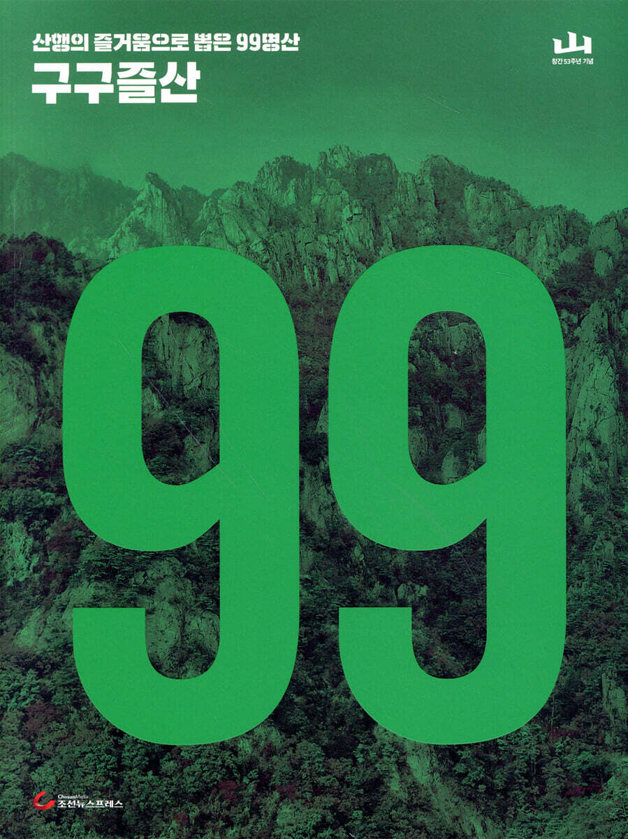
Gugujulsan Mountain
 |
Description
Book Introduction
I came to a famous mountain, but there was no scenery.
Attention, people who climb the steep mountain road that makes you out of breath!
The most detailed mountaineering map compiled from 53 years of expertise from the monthly magazine "Mountain"
Clear mountain commentary by veteran mountaineers, presented simply and clearly.
‘Gugujeulsan’ means 99 enjoyable mountain hikes.
Although Yuksan and Bawisan are different, and the views from the ridges and summits are also different, the intention is to enjoy the 99 joys of climbing each mountain together with the 『Gugujulsan』 map collection. 'The introduction contains only clear information about the mountain.
It contains representative landscape photos, height, area, main course, popular course, beginner course, charm, and realistic advice of the mountain.
The mountain heights are based on the latest mountain heights on the topographic map published by the National Geographic Information Institute.''The title of the book is '99 Famous Mountains,' but if you consider the surrounding mountains that are included on one map, such as 'Samgaksan + Mongdeoksan, Gadeoksan, Bukbaesan, Gyegwansan' or 'Cheonmasan + Cheolmasan,' there are actually many more than 99.
It is very helpful when hiking to a neighboring mountain or staying for a few days and hiking the surrounding mountains separately.
- Among the ways to use Gugujulsan
index
How to use Gugujulsan
Gugujulsan Mountain Information
01 Jirisan
02 Seoraksan Mountain
03 Bukhansan Mountain
04 Hallasan Mountain
05 Sobaeksan Mountain
06 Deogyusan Mountain
07 Juwangsan Mountain
August birth
09 Gyeryongsan Mountain
10 Naejangsan Mountain
11 Dobongsan Mountain
12 Gayasan
13 Gwanaksan Mountain
14 Daedunsan Mountain
15 Songnisan Mountain
16 Saryangdo Jirisan
17 Hwangmaesan Mountain
18 Wol-ak Mountain
19 Maisan
20 Shinbulsan
21 Suraksan Mountain
22 Jeamsan Mountain
23 Taebaeksan Mountain
24 Hambak Mountain
25 Myeongseongsan Mountain
26 Dutasan Mountain
27 Odaesan
28 Eungbongsan Mountain
29 Mani Mountain
30 Bangtaesan
31 Unmunsan
32 Mudeungsan
33 Gangcheonsan Mountain
34 Internal calculation
35 Chiaksan Mountain
36 Seonunsan Mountain
37 Byeonsan
38 Palyeongsan Mountain
39 Hwawangsan Mountain
40 Jujaksan
41 Namhae Geumsan
42 Seonginbong
43 Bisulsan Mountain
44 Mindungsan
45 Un'aksan Mountain
46 Dalmasan
47 Cheonhwangsan
48 Durun Mountain
49 Baekunsan Mountain
50 Cheonwansan Mountain
51 Oseosan Mountain
52 Udu Mountain
53 Minjujisan
54 Gukmangbong Peak
55 Gyebangsan Mountain
56 Chukryeongsan Mountain
57 Baekhwasan
58 Geoje Mangsan
59 Geumjeongsan Mountain
60 Palbongsan
61 Jollingsan Mountain
62 Palgongsan
63 Doraksan Mountain
64 Gyeongju Namsan
65 Namdeok Yusan
66 Domyeongsan
67 Bulgoksan Mountain
68 Muhaksan Mountain
69 Daeyasan
70 Unjangsan Mountain
71 Gamaksan Mountain
72 Geumosan Mountain
73 Yeongchwisan Mountain
74 Hwangseoksan Mountain
75 Samgaksan Mountain
76 Gibaeksan Mountain
77 Juheulsan
78 Geumsu Mountain
79 Gubongsan Mountain
80 Soyosan Mountain
81 Bul-am Mountain
82 Noinbong Peak
83 Heukseoksan Mountain
84 Sangwangbong
85 Jogeosan
86 Cheongnyangsan Mountain
87 Obongsan Mountain
88 Gariwangsan Mountain
89 Lovers Mountain
90 Yongmunsan
91 Famous Mountain
92 Gayasan
93 Seodaesan
94 Myeongjisan Mountain
95 Daebongsan
96 Moaksan Mountain
97 Dongaksan Mountain
98 Cheonmasan
99 Seolheulsan
Location of 99 famous mountains on a map of South Korea
& Index (alphabetical table of contents)
Detailed image

Publisher's Review
This is a groundbreaking collection of maps.
We ranked the fun of mountaineering from 1st to 99th in order of what no one tells you.
There was an unwritten rule in mountaineering that one must 'maintain purity'.
Ranking things by the 'fun of mountaineering' was a taboo.
『Gugujulsan』 broke this taboo.
It's not old information that has been copied from decades ago,
Based on my hiking experience in the 2020s, I've listed the mountains and included information.
It is not a measure of how deep or famous the history is.
We ranked the hikes from 1st to 99th purely based on the fun of the hike.
Jirisan Mountain was selected as the first place, while Seoraksan Mountain and Bukhansan Mountain took second and third places.
Why is Jirisan Mountain ranked first?
The joy we feel in the mountains cannot be quantified, but there are definitely mountains we love more.
Asking "Do you like Jirisan or Seoraksan better?" is like asking a hiker "Does your mom like it better? Does your dad like it better?"
It is a mountain that is so beloved by Korean mountaineers that it is difficult to rank it as number 1 or 2.
If you only look at the splendid mountain scenery, Seoraksan has the upper hand, but if you measure it by the measure of popular affection, Jirisan is ahead.
Jirisan has maintained its top spot with overwhelming numbers in mountain searches on various Internet sites.
The 'Jirisan Mountain Trail', which involves walking for several days through various shelters, is considered an experience that all Koreans must do before they die.
It is considered an adventure that even ordinary people who do not usually go hiking should try at least once.
The gentle ridge of Sangrime that never ends even after walking for several days, and the memories of the people I met on that ridge.
Is there any mountaineer who doesn't have a memory of walking ahead and behind each other, meeting at a shelter in the evening and sharing a meal?
Additionally, it is a famous mountain with a vast Jirisan perimeter trail that attracts people regardless of their height.
Jirisan is so vast that it is difficult to fit it on a single map, so it is divided into two maps, one for the east and one for the west.
The scale has been adjusted to optimize hiking in Jirisan.
Why were Mt. Hwaak, Mt. Jeombong, and Mt. Illim left out?
There is a reason why Mt. Hwaak, one of the five most dangerous mountains in Gyeonggi Province, was left out.
Due to the military base, the hiking trails on Mt. Hwaak are limited, and there is little scenery other than the narrow deck at the summit.
There are few course options, and the narrow, steep mountain paths continue for at least two hours, making it more of an ordeal than a hike for beginners.
Although Jeombongsan Mountain is a famous mountain known as a treasure trove of ecosystems, it is designated as a non-legal area of the national park and hiking is not permitted.
Since the ridges of Illimsan and Jeamsan are relatively close together, it would be unreasonable to include the two mountains as famous mountains separately.
Only the higher peaks of the main peak, Jeamsan, were included.
In this way, mountains that were conventionally included in the existing '100 Famous Mountains' were boldly excluded.
In the blank space, we included popular mountain climbing spots as of the 2020s.
These are newly emerging mountains such as Mangsan in Geoje, Seolheulsan in Namhae, Daebongsan in Hamyang, and Udusan in Geochang.
We have elevated this mountain to the ranks of famous mountains, where anyone can experience the true joy of mountaineering.
Representative courses, popular courses, and even the charm of the mountain
The introduction contains only clear information about the mountain.
It contains representative landscape photos, height, area, main course, popular course, beginner course, charm, and realistic advice of the mountain.
The mountain height was based on the latest mountain height on the topographic map published by the National Geographic Information Institute.
On the contour map, the heights are written down to the decimal point, and in the information column, the decimal points are omitted and rounded for readability.
The representative course is a course that allows you to see all the representative scenery of the mountain.
So, there are many courses that are long for a day hike, even though they are long distances.
Popular courses are the courses most frequently visited by mountaineers.
The beginner course contains the easiest courses.
It should be noted that this is not an absolute standard, as the subjective response of 'easy' or 'difficult' may vary depending on the beginner's physical strength.
The attraction simply captures the most famous and beautiful scenery on the mountain.
The practical advice includes things to keep in mind before hiking, such as 'there are many stairs, so hiking is not easy' or 'the hiking time is long compared to the distance'.
As such, the information page contains simple content, but it contains practical information that is difficult to obtain on the Internet.
Contains all the information that will help you with your mountaineering.
Map scales vary widely, including 1:50,000, 1:25,000, and 1:30,000.
Each mountain has a different width, and this is a natural phenomenon that occurs in the process of finding the optimal magnification ratio to show the course of that mountain.
What makes the 『Gugujeulsan』 map different from a regular topographic map is that it marks everything that could be of help in finding your way, such as bus stops at the entrance to the hiking trail, parking lots, restaurants, and accommodations.
It contains valuable information that is not displayed on Internet portal maps or National Geographic Information Institute topographic maps.
Why is it 99 famous mountains and not 100 famous mountains?
But why are they called "99 Famous Mountains" and not "100 Famous Mountains"? Anyone can climb a mountain whenever they want, and anyone can join them.
The mountain is always there, but it is not perceived with the same meaning by everyone.
Each person has memories of the mountain and it will have meaning.
The monthly magazine "Mountain" reporters have selected 99 famous mountains, so readers can choose their own special mountain to complete the list of 100 famous mountains.
GOODS SPECIFICS
- Publication date: August 10, 2022
- Page count, weight, size: 236 pages | 714g | 210*280*10mm
- ISBN13: 9791155784938
- ISBN10: 1155784936
You may also like
카테고리
korean


korean

![ELLE 엘르 스페셜 에디션 A형 : 12월 [2025]](http://librairie.coreenne.fr/cdn/shop/files/b8e27a3de6c9538896439686c6b0e8fb.jpg?v=1766436872&width=3840)


