

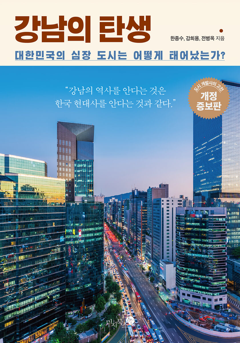
The birth of Gangnam
 |
Description
Book Introduction
In an undeveloped wasteland in a time when even the word 'Gangnam' was unfamiliar,
Until it became a 'special district' in the capital city of Seoul
History of Gangnam Development
First published in 2016, it was reborn as a revised and expanded edition in 2024.
A masterpiece of urban development
There was a time when even the word 'Gangnam' was unfamiliar.
This book introduces the history of Gangnam, which was once an undeveloped wasteland south of the Han River, growing into a representative city center of Korea and its capital, Seoul.
Back when it was still called 'Yeongdong,' the Gyeongbu Expressway, which would later drive economic growth, was built, and the Third Han River Bridge, which allowed people to cross the previously barrier-like Han River, was completed, marking the beginning of a period of full-scale development for Gangnam.
Through large-scale flood control projects, Gangnam was reborn as a huge development site, and the empty plains where there were no decent buildings were covered with grid-like roads.
And the main characters that made Gangnam what it is today—the famous apartments, streets, buildings, and countless incidents—begin to fill the space.
[The Birth of Gangnam] The revised and expanded edition significantly reflects the changes and new information that have naturally occurred over the course of 8 years and 14 printings since its first publication in 2016, thanks to the support of readers.
[The Birth of Gangnam], which has been expanded by nearly 100 pages compared to the first edition in 2016, is a new book for first-time readers, and provides the fun of comparing the changed inner workings of Gangnam for those who have already encountered it.
- You can preview some of the book's contents.
Preview
index
To the revised and expanded edition
Introduction (First Edition)
Part 1: Gangnam Development Begins
1.
Gangnam before development
A time when the name "Gangnam" was unfamiliar│The era of Gangnam development is imminent│A land brimming with potential incorporated into Seoul│The early, half-baked dreams│The Catholic Archdiocese of Seoul, once the "big landowner" of Gangnam
2.
Preparing for the automobile age
The Gyeongbu Expressway is laid, the Green Belt System is established, Gangnam's first bridge: the Third Hangang Bridge, and the express bus terminal is established.
3.
The flood control project that created Gangnam
The Great Flood of the Year of the Ox and the Following Floods│Renovating the Southern Bank of the Han River│The Goose That Lays Golden Eggs: Reclamation of Public Waters and Development of Residential Land│The Creation of Apartment Districts
4.
Gangnam Construction
The growing scale of development│Roads are laid in the empty fields│More bridges are connected│The birth of Gangnam-gu│The beginning of the apartment era│The rise and fall of apartment conglomerates│National institutions flocking to Gangnam│Becoming a mecca for large hospitals│Stories of churches and cathedrals│The true beginning of Gangnam: Banpo Public Housing Apartment Complex 1
5.
The Myth of District 8
Prestigious schools flock to Gangnam. A pioneering era for prestigious schools. The rise of new schools. A brief history of Daechi-dong, the center of private education.
6.
Early development landscape
Landmarks of Early Gangnam│Singing of Early Gangnam│Testimonies from Early Residents
Part 2: Gangnam Gets Bigger
7.
The Asian Games, the Olympics, and Jamsil
Jamsil before development│Jamsil development begins│Subway Line 2, passing through Gangnam│Asian Games and the Olympics│Jamsil Baseball Stadium and Main Stadium│Han River Comprehensive Development│The story of the Seoul Arts Center│The story of COEX│Asian Athletes' Village Apartments│The birth of Gangnam's three districts│Olympic Athletes' Village Apartments│The birth of Lotte World│Subway Line 3, passing through the north and south
8.
Gangnam, a special city for consumption
Gangnam's first hot spot: Bangbae-dong's cafe alley │ galbi restaurants and fast food joints │ a cradle of department store companies │ Gangnam's street casting and entertainment agencies │ dominated by foreign design firms
9.
Gangnam is getting bigger and bigger
The Stranger Jeong Tae-su Prepares for Suseo Development│The Shadow of Suseo Rental Apartment Complex│The Construction of Bundang New Town
10.
Gangnam's wealthy neighborhoods
Gangnam's first wealthy neighborhood: Apgujeong-dong │ Another face of Gangnam: Seocho-dong │ The least Gangnam-like, yet most Gangnam-like Cheongdam-dong │ The diverse faces of Samseong-dong │ Seorae Village
11.
The lungs of Gangnam
Bongeunsa Temple│Seonjeongneung Royal Tomb│Heoninreung Royal Tomb and Daemosan Mountain│Cheonggyesan Mountain and Umyeonsan Mountain│Yangjaecheon Stream│Dosan Park│Seoripul Park│Maeheon Citizen's Forest│A New Era in Modern Korean Parks: Olympic Park
12.
The Shadow of Gangnam
Land speculation spearheaded by the Blue House security service│Real estate speculation and the emergence of a concubine│Undefeated Gangnam real estate│Gangnam politics story│Broken bridge: Seongsu Bridge│Collapsed department store: Sampoong Department Store disaster│Room salons and organized crime│Bomb drink story│Gangnam slums│Gangnam's 'unwanted facilities'│Demon King Chun Doo-hwan│Continued flood risk│Inhumane city
13.
Current Gangnam
Changes in apartment structure│The boom in mixed-use housing: Dogok-dong high-rise mixed-use housing│Reconstructed apartments│Apartment branding│A mecca for plastic surgery│Samsung Town and a new skyline│Garosu-gil in Sinsa-dong│Golden line or hellish train: Subway Line 9│Gangnam Style│The stagnation of Gangnam apartment reconstruction│Tenam and Tebuk
14.
Seoul City Basic Urban Planning and Gangnam
What is the Urban Master Plan?│2000 Seoul Urban Master Plan and Gangnam│2011 Seoul Urban Master Plan and Gangnam│2020 Seoul Urban Master Plan and Gangnam│2030 Seoul Plan and Gangnam
Part 3 Gangnam
15.
Little Gangnams
Yeouido: The Original Gangnam | Nowon: Gangbuk's "Failed Gangnam" | Mokdong: Gangseo's "Successful Gangnam"
16.
Gangnam's influence
Lost in the Automobile Age│Gangbuk Overtaken by Gangnam: The New Town Redevelopment Issue│Local Cities Aspiring to Be Like Gangnam
In conclusion
Gangnam Development History Chronology
Copyright and Source of Illustration
References
Search
Into the book
Jamwon-dong, which used to be a mulberry field, had sandy soil that was good for growing radishes, so radish farming was successful, and Seocho-dong was a flower village where flowers were grown for the US military and people from Seoul.
Apgujeong was a pear orchard town, and Dogok-dong was a specialty of bellflower roots.
Cheongdam-dong, as its name suggests, was a valley with clear water.
The fruits and vegetables grown in the fertile lands of Gaepo-dong and Ilwon-dong were of high quality and were very popular among Seoulites because they were produced nearby.
/ The ferries that traveled across the Han River were loaded with fruits, vegetables, and fish caught in the Han River.
It's hard to imagine now, but the fastest way for residents of Gaepo-dong and Ilwon-dong to get to downtown Seoul was to take an engine boat from the Yangjaecheon Stream near the current Tower Palace, go up the Tancheon Stream, and get off at Ttukseom.
It is said that it took almost two days and one night to walk from this area to downtown Seoul, so Gangnam was that remote.
--- p.28~29
The public water surface reclamation project was a business that was so profitable that even Bong-i Kim Seon-dal would be surprised if he were reincarnated.
During the off-season from December to April, heavy equipment and labor are used to build embankments in the first year, and then sand is poured in during the off-season the following year to reclaim the public waters.
On the land thus created, they could build apartments themselves and sell them, or simply sell the land in bulk to state-run enterprises or government investment agencies.
Either way, it was a land-based, swimming-style business.
In this way, the Han River became a forest of apartments along with the riverside road.
--- p.66~67
Park Jong-gyu's question was simple and clear.
“Among the areas you saw by helicopter—Gwacheon, Seocho, Gangnam, and Jamsil—which one do you think has the most potential and investment value?” Jinwoo Yoon answered that the area west of Tancheon seemed the most promising.
It was the land that became Gangnam-gu today.
Park Jong-gyu instructed, “Then buy it and gather it.”
/ About two weeks later, when Jinwoo Yoon had almost forgotten about the incident, he received a call from the mayor's office.
When I got there, I was given the following instructions: “Go to the office of Taejin Ko, the executive director of Jeil Bank, and they will give you money. Get it and use that money to buy land first.”
/ “We buy land with money from high places, and when the land price rises to a certain level, we sell it and give it to the people.
When Jinwoo Yoon realized that this fact was a “top secret known only to one or two very high-ranking officials working at the Blue House, Seoul Mayor Hyunok Kim, and himself,” he became excited.
At that time, the Blue House had absolute power to decide the life and death of anyone.
Yoon Jin-woo said that he was so excited that he couldn't sleep because he thought, "If I look good to that adult, my path to success will be wide open."
--- p.256
The price of land in Maljukgeori, which was around 200 to 400 won per pyeong in early 1966, jumped to 6,000 won per pyeong in just two years by the end of 1968.
Although there was a temporary slowdown due to the imposition of real estate speculation suppression tax and economic recession, the rate of increase in land prices in Gangnam always exceeded that of other regions.
For example, when the land price level (index) in 1963 was 100, the land price in Hak-dong, Gangnam-gu in 1970 was 2,000, in Apgujeong-dong 2,500, and in Sinsa-dong 5,000.
In 7 years, they have increased by 20, 25, and 50 times respectively.
During the same period, prices in Sindang-dong, Jung-gu and Huam-dong, Yongsan-gu rose only 10-fold and 7.5-fold, respectively.
By 1979, the units had completely changed.
The land price index in Hakdong was 130,000, Apgujeong-dong 89,000, and Sinsa-dong 100,000.
According to this, over the 16 years from 1963 to 1979, land prices in Hakdong rose by a whopping 1,333 times, in Apgujeong-dong by 875 times, and in Sinsa-dong by 1,000 times.
During the same period, land prices in Sindang-dong and Huam-dong only increased by 25 times each.
Of course, this was partly because land prices in Gangnam were so low before, but even taking that into account, it was a truly astonishing increase in land prices.
--- p.262
Gangnam, where high-income professionals and a pro-government middle class began to settle down from the early stages of development, has even begun to experience a phenomenon of "distinction" after half a century.
The words that symbolically show this are ‘Tenam’ and ‘Tebuk’.
This term, which refers to the south and north of Teheran-ro, which runs through Gangnam-gu, was created by residents of Apgujeong-dong, Cheongdam-dong, Nonhyeon-dong, and Samseong-dong to mean that the area they live in, Tebuk, is the real Gangnam, and the area below it, called "Tenam," is not the real Gangnam.
This phenomenon is represented by the fact that when asked where they live, instead of saying Gangnam, they answer by saying, "I live in Apgujeong-dong" or "I live in Cheongdam-dong."
--- p.333
Publisher's Review
The history of Gangnam's development, a testament to modern history
Until recently, in our country, if there was a son who was good at studying, it was common to see the entire family making sacrifices for him.
If we compare it to a region, Gangnam would probably be the 'good son'.
No matter what anyone says, the Gangnam of today exists because prestigious schools and government agencies moved there and various special privileges were showered upon them.
Gangnam is filled with the stirring power and desire that has permeated modern Korean history.
This book, anticipating a new era of reconciliation, looks back on the breathless history of Gangnam's development, free from the obsession of jealousy and criticism, with a leisurely perspective.
Gangnam is the face of modern Korean history.
Knowing Gangnam is like knowing modern Korean history.
Seoul is bursting with people. Where should we develop?
In the 1960s, Seoul was saturated with people from all over the country.
The population explosion gave rise to various urban problems, including a housing shortage, and it began to be viewed as a serious security issue, especially in terms of capital defense.
This is because an excessively large population and important facilities have been concentrated in Gangbuk, which is only 40 kilometers from the Military Demarcation Line.
The Park Chung-hee regime decided to decentralize the functions of Seoul's downtown area to reduce its security burden.
So where should development take place? If our country hadn't been divided, Eunpyeong, Goyang, and Paju, located along the traditional central axis of Seoul-Gaeseong-Pyongyang, would have been developed far earlier than other areas of Seoul.
However, the memory of the suffering suffered by approximately one million citizens who were unable to cross the Han River during the Korean War and were left under communist rule was still vivid, and the late 1960s was a time when incidents such as the Pueblo hijacking incident and the Blue House attack by Kim Shin-jo and his gang broke out one after another.
Eventually, the Park Chung-hee regime turned its attention to Gangnam, south of the Han River.
A time when even the word 'Gangnam' was unfamiliar
Until 1963, the area we call 'Gangnam' today was a typical rural area in Gwangju-gun and Siheung-gun, Gyeonggi-do, mostly rice paddies and fields, with villages connected by small roads used by carts.
Nowadays, this place is called 'Gangnam', but in the past, the term 'Yeongdong', meaning 'east of Yeongdeungpo' or 'between Yeongdeungpo and Seongdong', was more commonly used.
In fact, the official name of the development plan that began in the 1970s was ‘Yeongdong Development’, not ‘Gangnam Development’.
In other words, 'Gangbuk' was Seoul, and people south of the Han River called the area across the river 'Seoul.'
Growing development scale
On January 1, 1963, when the administrative districts of Seoul were changed, the areas that correspond to present-day Gangnam were finally incorporated into Seoul.
In September 1966, the Seoul Metropolitan Government requested and received approval from the Ministry of Construction to designate 8 million pyeong from Banpo to Samseong-dong as a "land readjustment project area."
With this, it became a foregone conclusion that Gangnam development would begin.
However, the power and speed to push forward the development of Gangnam have not yet been properly demonstrated.
On February 1, 1968, the groundbreaking ceremony for the Gyeongbu Expressway was held, and the following day, on February 2, the Yeongdong District Readjustment District implementation notice was issued.
The first Yeongdong District Reorganization Area was 3.13 million pyeong in size.
However, in the process of securing 90,000 pyeong of land for highways and public land as instructed by the government, the land readjustment area increased to 5.2 million pyeong, and by the late 1970s, it had reached a whopping 9.37 million pyeong.
When you consider that the area within Sadamun is only 5 million pyeong, you can get a sense of how vast Gangnam is.
As a result, the Seoul Metropolitan Government changed its original plan to gradually develop this vast space in units of appropriate area, and it became necessary to urbanize this vast space.
The government and the Seoul Metropolitan Government will mobilize many policy tools to strategically develop Gangnam.
And in just over ten years, Gangnam has been completely transformed into a modern city.
The Third Han River Bridge connecting Gangnam and Gangbuk
Gangnam was a vast land, and that alone had enormous development potential.
But the Han River was a big barrier.
Although bridges over the Han River are common today, building a bridge over the Han River was a major national event at the time.
It took nearly half a century for the second bridge, the Yanghwa Bridge (second Hangang Bridge), to be built after the first Hangang Bridge (Hangang Bridge), which was built in 1917.
However, if only a bridge could be built over the Han River, Gangnam would be just a stone's throw from the existing city center.
On December 25, 1969, the Third Han River Bridge was finally completed.
This bridge was the first bridge to truly connect Gangbuk and Gangnam across the Han River.
It later became an important factor in the skyrocketing land prices that came to be known as the 'Maljukgeori myth', and on the other hand, it was connected to the Gyeongbu Expressway, which had begun construction before that, and became its starting point.
Afterwards, the Third Han River Bridge became the umbilical cord that gave birth to the region called ‘Gangnam’ from ‘Gangbuk’.
Reborn as a massive development site
Another weakness of Gangnam was that it was often flooded due to its low-lying area.
Gangnam was a land that could not function as a city without extensive flood control measures, as the saying goes, “You can live without a husband or wife, but not without boots.”
After the great flood of 1925, there was a levee built by the Japanese, but it could only protect Wonhyo-ro, Yeongdeungpo, and Noryangjin.
In other words, the areas of Mapo, Ttukseom, Gwangjin, Gangnam, Yeouido, and Jamsil were all submerged in water when there was a flood.
Development of the Han River began in 1967 to make it the central living area of Seoul.
The first step was taken by constructing Gangbyeon 1-ro as an embankment road.
Although embankments are embankments, a large dam was needed to maintain the water volume and level of the Han River at a constant level, and the Soyang River Dam was completed in 1973.
Through these flood control projects, Seoul citizens were freed from the fear of floods.
The area that benefited the most was, of course, Gangnam.
This was followed by the development of residential land through the reclamation of 'shared waters', and Gangnam was reborn as a truly gigantic development site.
At the same time, in Gangnam, as many as 37 main roads, including wide roads and avenues with widths of 40 to 90 meters, were laid out in a grid pattern.
This type of road network was the first of its kind in Korea, and it felt strange to see the roads cut straight through the vast plains, especially before any proper buildings or facilities were built.
“Why on earth do we need such wide roads?” many wondered.
But as time passed, Gangnam's roads became clogged with cars, and high-rise buildings rose in place of each once-empty block, forming a stunning skyline.
In the process, many people and companies left their stories behind, and buildings that would become landmarks appeared one after another.
An apartment district is created
Although the water defense project and reclamation of shared waters were completed, the area around Banpo and Seocho-dong, located slightly inland from the Han River, was still lower than the riverside road.
In principle, the land should have been raised by properly reclaiming the land, but the Seoul Metropolitan Government was unable to do so due to the enormous cost.
Because of this, if there was a severe flood or lightning strike and the power supply to the drainage pump station was cut off, the low-lying areas would inevitably be flooded.
So, at the time, Seoul Mayor Yang Taek-sik came up with a desperate measure to require all low-lying areas to build houses three stories or higher.
In the worst case scenario, the calculation was that if residents evacuated to the third floor or higher, there would be no casualties.
Thus, a massive 'apartment district' encompassing the entire flood-prone area was officially born in Gangnam.
Meanwhile, a large number of residents were needed for smooth development.
Initially, the first apartment complex in Gangnam, the Nonhyeon-dong Civil Servant Apartment, was built, and the Yeongdong Housing Complex was developed and successfully sold out, but these were too small in scale.
That was not enough to fill the wide space of Gangnam.
And finally, in August 1976, the 'apartment district' was officially announced.
The apartment districts established in Gangnam, such as Banpo District (1.67 million pyeong), Apgujeong District (360,000 pyeong), Cheongdam District (110,000 pyeong), Dogok District (220,000 pyeong), and Jamsil District (745,000 pyeong), were overwhelmingly large and incomparable to other regions.
Here, large apartment complexes representing Gangnam today began to be built.
The Growing Gangnam: Jamsil, Suseo, and Bundang
The Yeongdong development, which was on a scale beyond imagination, was surprisingly completed in just over 10 years.
However, the momentum of development did not slow down, and Gangnam continued to expand.
In the 1980s, the Chun Doo-hwan regime developed Jamsil in hopes of hosting the Asian Games and the Olympics.
The Asian Athletes' Village Apartments and the Olympic Athletes' Village Apartments built at this time further advanced apartment culture and, above all, played a decisive role in tying Jamsil to the Gangnam area.
In addition, landmarks that would become Gangnam's symbols for a long time, such as Jamsil Sports Complex, Seoul Arts Center, and COEX, were established during the Chun Doo-hwan regime.
Even during the Roh Tae-woo administration, Gangnam development expanded to areas such as Suseo, Ilwon, and Bundang.
The Shadow of Development: Disappeared Things and Dark Memories
This book takes a close look at places of old memories that disappeared during the Gangnam development period.
It introduces in detail the regret over the old Han River scenery that disappeared when embankments were built and riverside roads were created as part of the flood control project, the story of Jeojado Island between Apgujeong-dong and Oksu-dong in the early 1970s that disappeared because it was mined as aggregate for the construction of a large apartment complex, the story of Bamseom Island that suffered a similar fate to Jeojado Island during the development of Yeouido, and the story of how the Songpa River that flowed to the south of Jamsil Island disappeared as a result of the Jamsil Flood Control Project, leaving only Seokchon Lake.
In addition, numerous behind-the-scenes stories await readers in each Gangnam development scene.
Episodes that have now become history, such as real estate speculation led by powerful government figures, the Suseo incident caused by Hanbo Group Chairman Chung Tae-soo, and the stories surrounding the broken Seongsu Bridge and the collapsed Sampoong Department Store, which remain throughout Gangnam, were also recorded as important parts of Gangnam's development history.
The most Seoul-like Seoul is Gangnam.
Since the Joseon Dynasty, Seoul has gradually expanded its territory.
If the capital of Joseon was Hanyang, located within the Four Great Gates, during the Japanese colonial period, the Japanese took the lead in forming a new city centered around Myeongdong.
And in modern times, Gangnam was newly incorporated and grew into a representative downtown area of Seoul.
In this way, the most Seoul-like Seoul may not be Hanyang of the Joseon Dynasty, nor Gyeongseong, which was built by Japan, but Gangnam.
But Gangnam's success cast a deep shadow over our country's urban history.
The New Town craze that once swept Seoul was a reflection of the desires of people in Gangbuk who had been overtaken by Gangnam.
From some point on, not only metropolitan cities like Busan and Daegu, but even small cities began developing new towns following the Gangnam development process as if they had learned some secret recipe.
And many provincial cities lost their old downtown areas and became just ordinary, characterless cities.
Nowadays, no developer calls the 63 Building, Olympic Road, or Jamsil Main Stadium the pride of Seoul.
It is certain that those times have passed.
This book goes beyond telling the history of Gangnam to reflect on our society being drawn to Gangnam and discusses the present and future of our cities.
GOODS SPECIFICS
- Date of issue: October 30, 2024
- Page count, weight, size: 404 pages | 602g | 154*217*26mm
- ISBN13: 9791190498630
- ISBN10: 1190498634
You may also like
카테고리
korean


korean

![ELLE 엘르 스페셜 에디션 A형 : 12월 [2025]](http://librairie.coreenne.fr/cdn/shop/files/b8e27a3de6c9538896439686c6b0e8fb.jpg?v=1766436872&width=3840)


