

Globe Lesson 2
 |
Description
Book Introduction
World's first
The amazing history of the Earth seen through a '3D globe'!
The world seen through a round globe
How different is the world from what we see on a flat world map?
Until now, the Earth (world) in our heads has mostly been in the form of a 'flat world map'.
Because I can see all the land and seas of the world at a glance, I have never once questioned that 'perception' itself.
But that is not the 'real' picture of the Earth and the world.
Because there are things you can never know unless you look at them on a three-dimensional globe.
This book, “Globe Class (1ㆍ2),” removes the distortions and limitations that flat maps inevitably have and captures the true image of the Earth and the world.
It is the world's first to include a vivid globe, over 200 colorful maps, and over 240 rich historical and cultural illustrations, integrating them into a three-dimensional 'full history of the Earth.'
In today's world, where any place in the world has become a one-day living sphere, what we living in the 21st century must see is not one country, one incident, or one war.
We must follow the traces of life that humanity has carved on this three-dimensional space called Earth.
That is the eye that sees the 'real' world.
Now, instead of a world map stuck on the wall, it's time to place a spinning globe on the table and look at the world with more three-dimensional and living eyes.
Through this book, “Globe Class,” let’s go on a ‘real’ world tour.
- You can preview some of the book's contents.
Preview
index
preface
Note
7 To the center of the West, Europe!
Europe, the protagonist of the modern world
Eastern Europe
-Turkiye
From lake to sea, the Caspian Sea
-Azerbaijan
-Armenia
-Georgia
Balkan Peninsula
Greece is Greece
-Bulgaria
-Former Yugoslav Republics
-Albania
Countries around the Black Sea
-Romania
-Moldova
-Ukraine
-Baltic countries
Other Eastern European countries
-Poland
-Belarus
-Hungary
-Czech Republic and Slovakia
From Königsberg to Kaliningrad
-russia
Northern Europe
-Three Scandinavian countries
-Finland
-Iceland
Western Europe
-Benelux countries
-france
French Revolution
-germany
-uk
Commonwealth/What on earth is the name of the country?/The Birth of Britain
-Ireland
Northern Ireland/British flag
-Austria
-Swiss
-Liechtenstein
Southern Europe
small countries in Southern Europe
-Monaco
-San Marino
-Andorra
-Malta
-Italy
-Spain
-Portugal
8 To America!
The emergence of a huge colonial continent
The Secret of the World Map! / Columbus / North America, South America, and Latin America
Central America
Caribbean Islands/Independent States of the Caribbean Islands
-Cuba
-Puerto Rico
-Dominica
-Trinidad and Tobago
-Haiti
Colonies in the Caribbean
Central American countries
-Guatemala
-El Salvador
-Honduras
-Belize
-Nicaragua
-Costa Rica
-Panama
North America
-Canada
-USA
The Departure of the United States/American Independence/Louisiana Purchase/Florida Purchase/Texas Annexation/Oregon/California Annexation/Alaska Purchase/Hawaii, the 50th State/Other U.S. Territories
-Mexico
South America
Simon Bolivar/San Martin
-Guyana, Suriname, and Guiana
-brazil
-Argentina
Eva Fern
-Uruguay
-Paraguay
-Pire
9 Antarctica
Earth's common assets that must be protected
Search
Detailed image
.jpg)
Publisher's Review
From world travel to understanding geography, history, the environment, and geopolitics.
A groundbreaking globe class that surpasses 〈World Theme Travel〉, 〈The Power of Geography〉, and 〈World Report〉!
1.
Why "Globe"? Things you can't know without looking at a globe!
The greatest advantage of the world map we commonly use is that it allows us to see all of the Earth's land and sea at a glance.
But sometimes, when I look at a globe, I am surprised and think, “Is this country (or this ocean) this big? (or is it small?)”
Representative examples are ‘Greenland’ and ‘Pacific Ocean’.
Greenland (approximately 2,175,600 km²), located near the North Pole, is the world's largest island, but its area is significantly smaller than that of India (approximately 3,287,000 km²) or China (approximately 9,596,960 km²).
But on a world map, Greenland appears larger than India or China.
The same goes for the Pacific.
Although the Pacific Ocean is a very large ocean that covers about 34% of the Earth's surface area (about 165,246,000 km²), it does not appear to be that large on a world map compared to the Arctic or Southern Oceans.
Why is this? The fatal flaw of a flat world map is that it causes area distortion like this.
The closer you are to the equator, the smaller it appears, and the closer you are to the poles, the larger it appears in reality.
It's not just the distortion of area.
The flat world map has deeply distorted our sense of 'time/space' and 'distance'.
For example, there is the misconception that flights from South Korea to the United States cross the Pacific Ocean (in fact, they use the Arctic route), and the familiar notion that the world is centered around the Pacific Ocean, with Asia and America facing each other (in contrast, Europeans believe that Europe and America face each other with the Atlantic Ocean as the center).
However, if we look at it as a 'globe', this illusion cannot occur.
We quickly realize that it is much closer to fly through the North Pole than to fly east to west across the vast Pacific Ocean, and since the 'real' world has no 'center', our view can spread out in all directions.
Likewise, we can intuitively understand the time difference and distance difference of 'one day' across the International Date Line.
As the world's lands and seas are transferred to the globe, many new things are revealed.
The world seen through the globe is quite different from the world we have known so far.
After reading this book, your perspective on the world will change and the world will appear much more colorful.
2.
Includes over 440 rich illustrations, including the world's first globe illustration!
A book packed with in-depth knowledge on geography, history, politics, economics, culture, and environment from around the world!
To properly travel the globe, you need some prior knowledge.
To this end, we first present the core concepts of the Earth and geography, such as the Earth's revolution and rotation, continents and oceans, mountain ranges and lakes, latitude and longitude, the International Date Line and the Prime Meridian, in an easy and concise manner.
And the fascinating and diverse stories of the geography, history, politics, economy, culture, and environment of over 200 countries on Earth unfold like a panorama with over 440 illustrations (over 200 illustrations of globes and maps, and over 240 illustrations of history and culture).
In particular, the globe illustrations included in the book were personally created and included to show the three-dimensional perspective of this book.
Additionally, charts are provided throughout the country to provide basic information needed to understand each country at a glance, such as each country's flag, capital, area, religion, language, population, ethnic distribution, and GDP per capita.
In short, it provides a three-dimensional perspective that covers the entire globe, from past to present, and allows you to see everything from world history to geopolitics.
The way the content is described is also not a uniform structure as seen in general map books or geography books.
Like a multi-focus lens, it sometimes provides a detailed look into the interior of a country, and at other times reveals the interconnectedness of religions, cultural spheres, historical continuity, geopolitical issues, and environmental problems.
Furthermore, the book is packed to the brim with knowledge, from the 440 or so illustrations to the pop-up tips provided throughout, making it truly "thoroughly" filled with knowledge.
3.
Divided into two volumes for easy viewing, with a convenient 'Search' function to easily find the content you want.
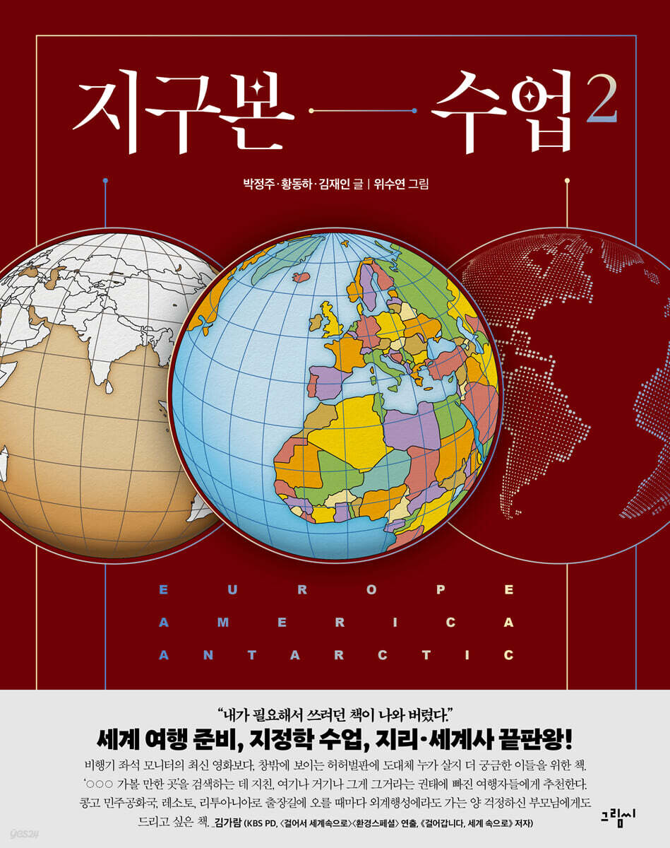
This book consists of Volume 1, which covers the continents of Asia, Africa, and Oceania, and Volume 2, which covers the continents of Europe, America, and Antarctica.
Rather than thick 'sticky notes' that are likely to be stuck in the house for decoration, it is intended to encourage people to open books more often and more easily.
Additionally, since it contains a very large and diverse amount of data and information, a detailed 'index' that combines volumes 1 and 2 is included at the end of each volume, allowing you to quickly find the content you want at any time.
You can find the information you need not only by 'searching' by country or map, but also by reading the text and explanations of the illustrations.
Additionally, page numbers are included throughout the text to help you find other pages with related content.
Knowledge of integration spreads out like a panorama across the globe!
★ Includes over 200 colorful maps, including a vivid globe, and over 240 rich historical and cultural illustrations!
★'Core concepts of geography' such as revolution and rotation, continents and oceans, mountain ranges and lakes, latitude and longitude, the International Date Line and the Prime Meridian
★From geography, history, politics, economy, culture, environment, and even GDP per capita across 203 countries across 6 continents!
★A time travel around the globe that spans human history, from the birth of Homo sapiens to the future world.
★Conflicts and conflicts around the world, key issues in diplomacy and geopolitics
★From the Ptolemaic world map to the Orsagraph projection, "Everything About Maps" for map nerds.
★From the North Pole to the South Pole, Today's Earth Seen Through Environmental Issues
A groundbreaking globe class that surpasses 〈World Theme Travel〉, 〈The Power of Geography〉, and 〈World Report〉!
1.
Why "Globe"? Things you can't know without looking at a globe!
The greatest advantage of the world map we commonly use is that it allows us to see all of the Earth's land and sea at a glance.
But sometimes, when I look at a globe, I am surprised and think, “Is this country (or this ocean) this big? (or is it small?)”
Representative examples are ‘Greenland’ and ‘Pacific Ocean’.
Greenland (approximately 2,175,600 km²), located near the North Pole, is the world's largest island, but its area is significantly smaller than that of India (approximately 3,287,000 km²) or China (approximately 9,596,960 km²).
But on a world map, Greenland appears larger than India or China.
The same goes for the Pacific.
Although the Pacific Ocean is a very large ocean that covers about 34% of the Earth's surface area (about 165,246,000 km²), it does not appear to be that large on a world map compared to the Arctic or Southern Oceans.
Why is this? The fatal flaw of a flat world map is that it causes area distortion like this.
The closer you are to the equator, the smaller it appears, and the closer you are to the poles, the larger it appears in reality.
It's not just the distortion of area.
The flat world map has deeply distorted our sense of 'time/space' and 'distance'.
For example, there is the misconception that flights from South Korea to the United States cross the Pacific Ocean (in fact, they use the Arctic route), and the familiar notion that the world is centered around the Pacific Ocean, with Asia and America facing each other (in contrast, Europeans believe that Europe and America face each other with the Atlantic Ocean as the center).
However, if we look at it as a 'globe', this illusion cannot occur.
We quickly realize that it is much closer to fly through the North Pole than to fly east to west across the vast Pacific Ocean, and since the 'real' world has no 'center', our view can spread out in all directions.
Likewise, we can intuitively understand the time difference and distance difference of 'one day' across the International Date Line.
As the world's lands and seas are transferred to the globe, many new things are revealed.
The world seen through the globe is quite different from the world we have known so far.
After reading this book, your perspective on the world will change and the world will appear much more colorful.
2.
Includes over 440 rich illustrations, including the world's first globe illustration!
A book packed with in-depth knowledge on geography, history, politics, economics, culture, and environment from around the world!
To properly travel the globe, you need some prior knowledge.
To this end, we first present the core concepts of the Earth and geography, such as the Earth's revolution and rotation, continents and oceans, mountain ranges and lakes, latitude and longitude, the International Date Line and the Prime Meridian, in an easy and concise manner.
And the fascinating and diverse stories of the geography, history, politics, economy, culture, and environment of over 200 countries on Earth unfold like a panorama with over 440 illustrations (over 200 illustrations of globes and maps, and over 240 illustrations of history and culture).
In particular, the globe illustrations included in the book were personally created and included to show the three-dimensional perspective of this book.
Additionally, charts are provided throughout the country to provide basic information needed to understand each country at a glance, such as each country's flag, capital, area, religion, language, population, ethnic distribution, and GDP per capita.
In short, it provides a three-dimensional perspective that covers the entire globe, from past to present, and allows you to see everything from world history to geopolitics.
The way the content is described is also not a uniform structure as seen in general map books or geography books.
Like a multi-focus lens, it sometimes provides a detailed look into the interior of a country, and at other times reveals the interconnectedness of religions, cultural spheres, historical continuity, geopolitical issues, and environmental problems.
Furthermore, the book is packed to the brim with knowledge, from the 440 or so illustrations to the pop-up tips provided throughout, making it truly "thoroughly" filled with knowledge.
3.
Divided into two volumes for easy viewing, with a convenient 'Search' function to easily find the content you want.
This book consists of Volume 1, which covers the continents of Asia, Africa, and Oceania, and Volume 2, which covers the continents of Europe, America, and Antarctica.
Rather than thick 'sticky notes' that are likely to be stuck in the house for decoration, it is intended to encourage people to open books more often and more easily.
Additionally, since it contains a very large and diverse amount of data and information, a detailed 'index' that combines volumes 1 and 2 is included at the end of each volume, allowing you to quickly find the content you want at any time.
You can find the information you need not only by 'searching' by country or map, but also by reading the text and explanations of the illustrations.
Additionally, page numbers are included throughout the text to help you find other pages with related content.
Knowledge of integration spreads out like a panorama across the globe!
★ Includes over 200 colorful maps, including a vivid globe, and over 240 rich historical and cultural illustrations!
★'Core concepts of geography' such as revolution and rotation, continents and oceans, mountain ranges and lakes, latitude and longitude, the International Date Line and the Prime Meridian
★From geography, history, politics, economy, culture, environment, and even GDP per capita across 203 countries across 6 continents!
★A time travel around the globe that spans human history, from the birth of Homo sapiens to the future world.
★Conflicts and conflicts around the world, key issues in diplomacy and geopolitics
★From the Ptolemaic world map to the Orsagraph projection, "Everything About Maps" for map nerds.
★From the North Pole to the South Pole, Today's Earth Seen Through Environmental Issues
GOODS SPECIFICS
- Date of issue: September 10, 2024
- Page count, weight, size: 248 pages | 630g | 190*240*17mm
- ISBN13: 9791189231606
- ISBN10: 1189231603
You may also like
카테고리
korean


korean

![GQ KOREA Mark (Monthly): December [2025]](http://librairie.coreenne.fr/cdn/shop/files/8ef265dbbfbf186523ed75ba7319009d.jpg?v=1765340328&width=3840)


